
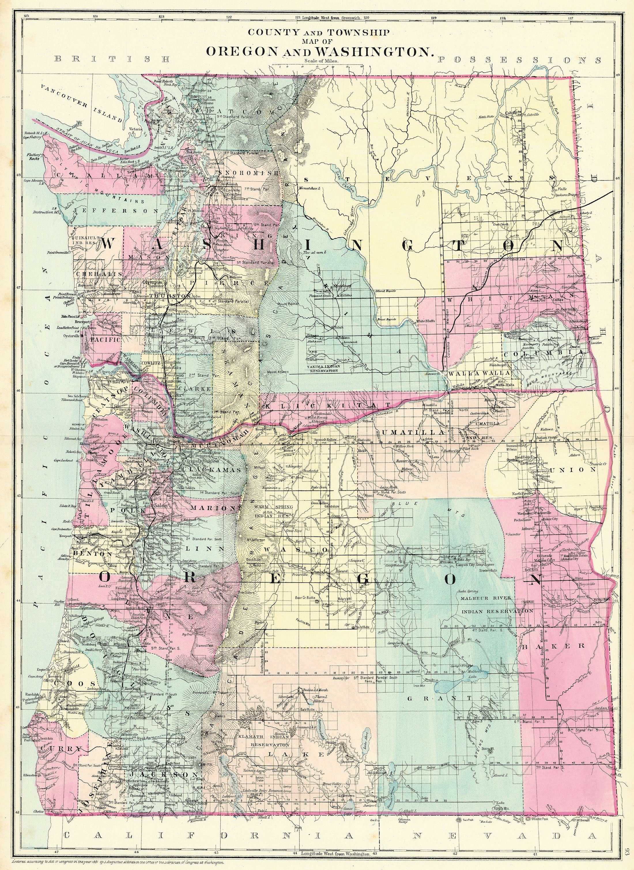
- Title: County and Township Map of Oregon and Washington
- Author: Augustus Mitchell
- Date: 1881
- Medium: Hand-colored lithograph
- Condition: Excellent- light age toning, issued center fold
- Inches: 15 1/4 x 23 [Paper]
- Centimeters: 38.74 x 58.42 [Paper]
- Product ID: 319083
Map of Oregon and Washington by Philadelphia publisher Augustus Mitchell. Shows parts of California, Nevada, Idaho, present-day Canada, and Vancouver Island. Map marks the locations of Native reservations, railroad lines, and township and county boundaries.