
- Title: California Official Tourist Picture Map
- Author: Charles Owens / The All-Year Club
- Date: 1936
- Condition: Good - Wear along original folds with minor paper loss at edges of some folds
- Inches: 38 x 16 1/2 [Paper]
- Centimeters: 96.52 x 41.91 [Paper]
- Product ID: 308121
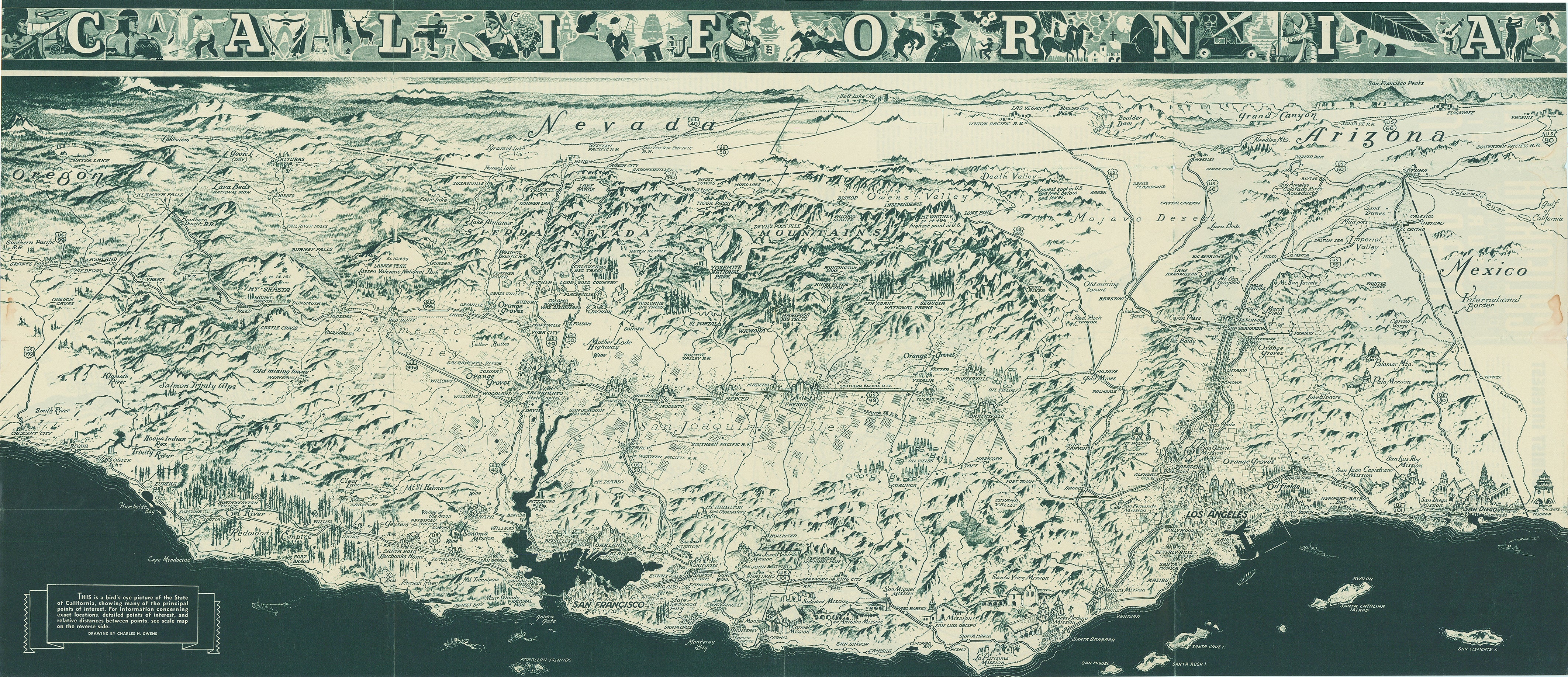
This distinctive bird's-eye view of the state of California was illustrated by Charles H. Owens, a Californian known for his stunning aerial perspective maps. This view shows California from a three-dimensional perspective, with mountains, buildings and even oil rigs drawn pictorially. Roads, railroads, and key attractions are also illustrated. The title at top is filled with images relating to the history of the state.
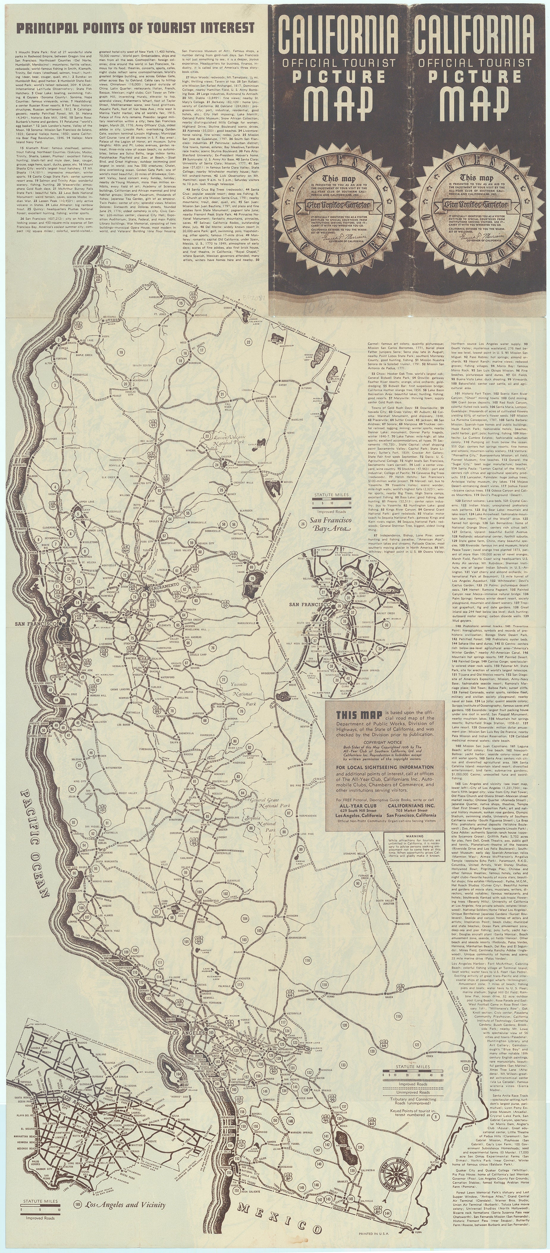
On verso is an official roadmap from the Department of Public Works with a numbered guide to cities and sites of interest throughout the state. The folding pamphlet includes a "Guest of California" seal signed by California Governor Frank F. Merriam granting visitors "special courtesies" and extending "the warmest of welcomes." However, having been published during the Great Depression, there is also a warning: "While attractions for tourists are unlimited in California, it is necessary to advise persons seeking employment not to come here at this time. When opportunity arises California will gladly make it known." Published by the All-Year Club of Southern California and Californians, Inc.
Charles Hamilton Owens (1881-1958) had an early and natural skill for sketching. He dropped out of school after the third grade and began his career in newspapers, first as an errand boy and eventually graduating to the art department after his artistic talent was recognized. He spent his career at various newspapers, retiring from the Los Angeles Times in 1953 after 32 years with the paper. He was best known for his aerial perspective maps and his quick sketching ability. He was also known to have sketched while flying in planes and even while driving a car.