
- Title: IRELAND
- Author: John Arrowsmith
- Date: 1832
- Condition: See description
- Inches: 18 3/4 x 23 3/4 [Image]
- Centimeters: 47.62 x 60.32 [Image]
- Product ID: 308231
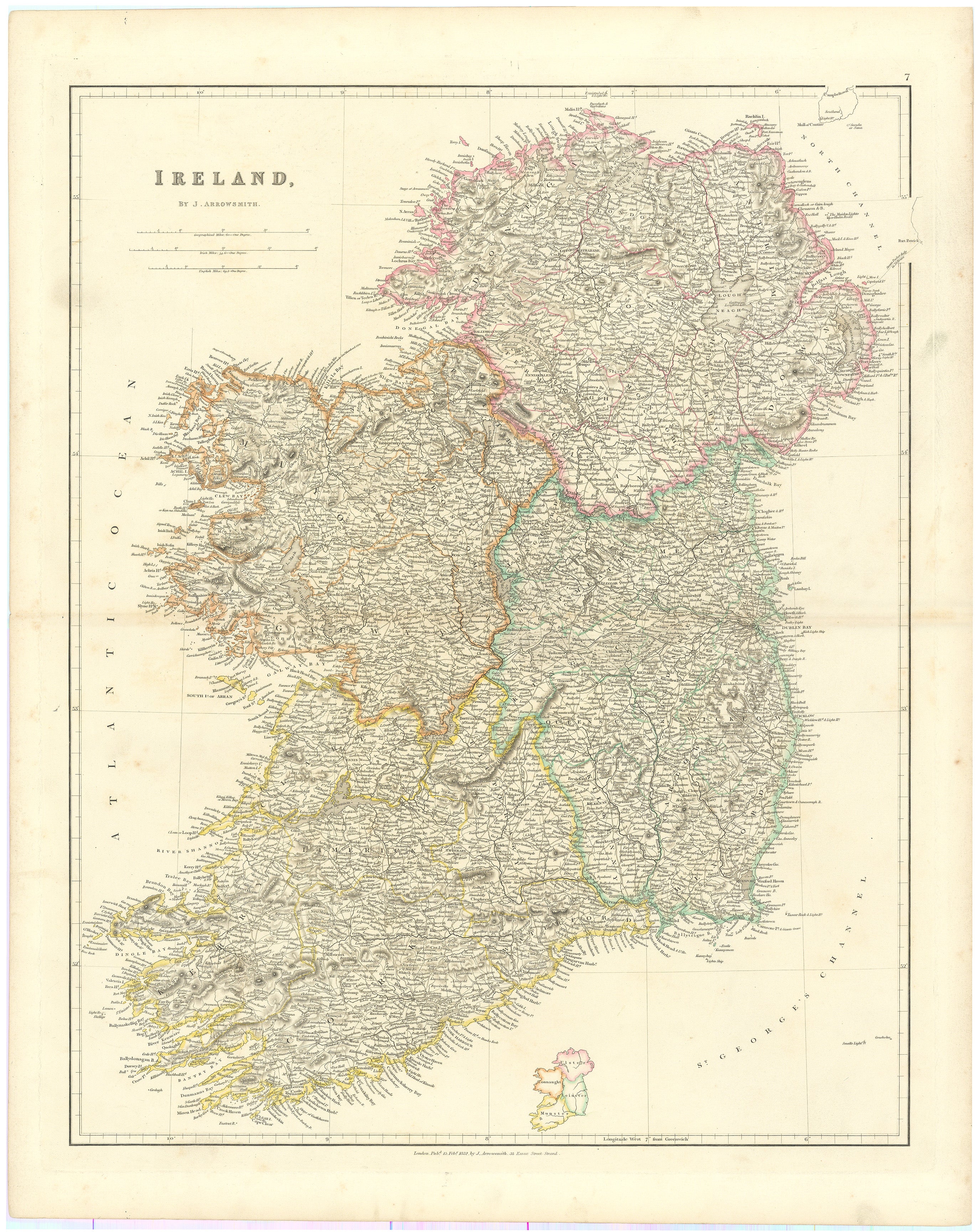
Arrowsmith Ireland Highlighting the Four Provinces
Scarce Arrowsmith atlas map of Ireland from the London Atlas of Universal Geography. With a small inset map showing the four provinces in fine wash color, the map with the provinces in corresponding outline color.
There are four provinces of Ireland: Connacht, Leinster, Munster and Ulster. The Irish word for this territorial division, cúige, meaning "fifth part", suggests that there were once five, and at times Meath has been considered to be the fifth province. In the medieval period, however, there were often more than five. Each province was ruled by a "king of over-kings", known as a rí ruírech. This was the highest rank allowed for in Irish law tracts despite claims by some dynasties to the symbolic title of High King of Ireland. The provinces were divided into smaller territorial units that corresponded roughly to the size of modern Irish counties or dioceses and were ruled by an overking.
The number of provinces and their delimitation fluctuated until 1610, when they were permanently set by the English administration of James I. The provinces of Ireland no longer serve administrative or political purposes but function as historical and cultural entities.
Background on Creator
John Arrowsmith (1790–1873) was a renowned British cartographer of the 19th century and a founding member of the Royal Geographical Society. His London Atlas of Universal Geography was one of the most influential of the period, and later versions (1842 and after) with the map of Texas are highly prized by institutions and collectors. He was the nephew of Aaron Arrowsmith and a member of one of the most prolific and accomplished cartographic families.
John Arrowsmith is known for his detailed and accurate maps. He produced a variety of maps, atlases, and globes, and his work was highly regarded for its quality and precision. Arrowsmith's maps were used for various purposes, including exploration, navigation, and geography education. His maps of the world and various regions were influential in their time and contributed to a better understanding of the geography of the 19th century.
One of his most significant works is the "Arrowsmith Atlas," which was published in several editions and contained a collection of maps covering different parts of the world. His contributions to cartography played a vital role in the dissemination of geographic knowledge during the 19th century.
Condition
Wide margined example in untouched condition, dust soling and smudges, mostly marginal. Slight discoloration at central join. Excellent.