
- Title: Road-Map of Fifty Miles Around London
- Author: G. W. Bacon & Co.
- Date: c. 1900
- Condition: Very Good - original softcover binding, age toning, areas of surface dirt, minor separations at issued folds
- Inches: 30 1/2 x 23 [Paper]
- Centimeters: 77.47 x 58.42 [Paper]
- Product ID: 317064
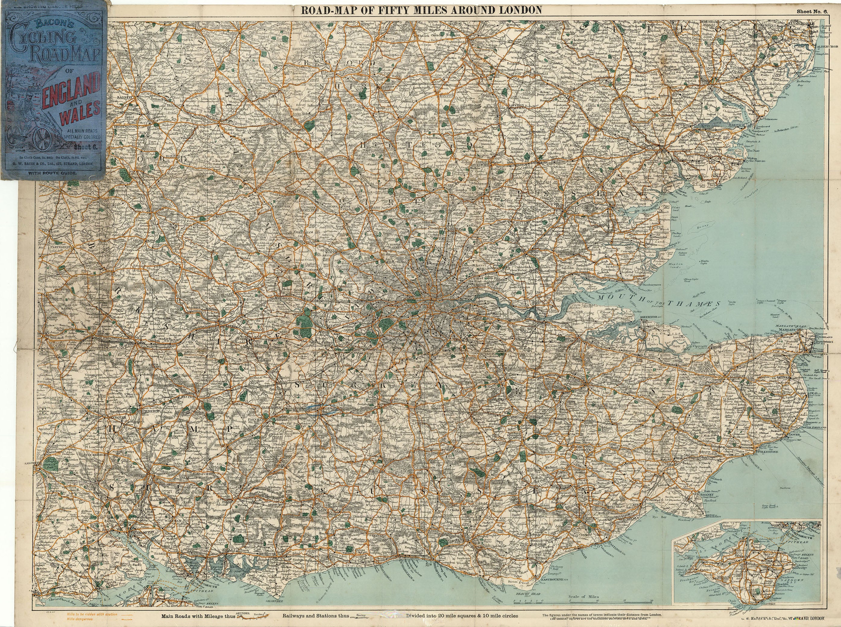
Sheet 6 of Bacon's Cycling Roadmap of England and Wales showing southeast England around the city of London. Map marks the region's primary roads, railway stations, 'Hills to be ridden with caution,' and 'Hills dangerous.' Park areas appear in green. Inset in lower right corner showing the Isle of Wight.
Background on Creator
G. W. Bacon & Co. was a London-based map publishing firm founded around 1870 by American cartographer George Washington Bacon, who had moved from New York to Britain in the 1860s and initially worked with Joseph Colton before launching his own business. The firm grew by acquiring and reworking Edward Weller’s English county plates from the Weekly Dispatch Atlas, which Bacon expanded, clarified, and issued in influential late-Victorian atlases such as The New Ordnance Atlas of the British Isles in the 1880s. G. W. Bacon & Co. became known for detailed folding maps and large-scale atlases of London, the British Isles, and the world, and it further strengthened its London coverage by purchasing the map business of James Wyld in the 1890s. Around the turn of the twentieth century the company was acquired by the Scottish firm W. & A. K. Johnston, but the Bacon imprint continued in use for atlases and street guides well into the mid‑twentieth century, preserving the brand’s association with clear, practical cartography.