
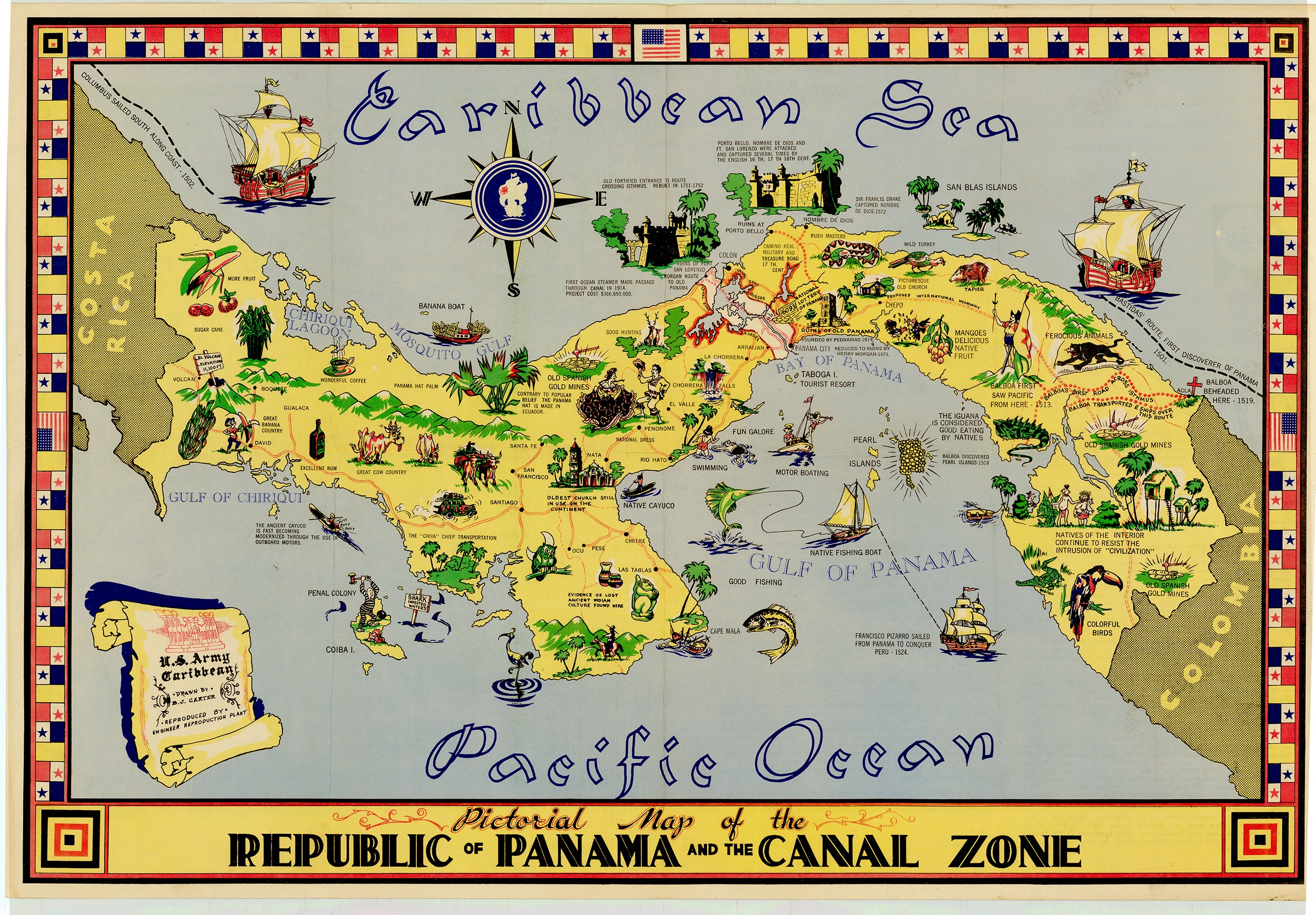

- Title: Pictorial Map of the Republic of Panama and the Canal Zone
- Author: B.J. Carter
- Date: 1951
- Medium: Printed color
- Condition: Issued folding, minimal wear, an above average example
- Inches: 15.75 x 23.5 [Paper]
- Centimeters: 40.1 x 59.69 [Paper]
- Product ID: 311010
Colorful Panama Canal Zone Map
USARCARIB COROZAL. C. Z, 1951
Humorous map with extensive historical information, local flora and fauna, roads, resources, products, indigenous people, and leisure activities. Printed by the US military for service members stationed in the zone. The center of the compass rose and the scroll in the lower left were printed with various things depending on the map recipients. This map is printed with "U.S. Army Caribbean…” in the scroll and a Man of War in the compass rose.
The verso features A Brief History of the Panama Canal and facts About the Canal, extensively documenting the canal and its construction, noting the excavation moved 199 times the amount of material used in the Great Pyramid at Giza. Portrays a detailed birds eye view of the canal with inserted sketches of the locks.