
- Title: An Entire New Plan of the Cities of London & Westminster...
- Author: William Darton
- Date: 1817
- Condition: See bottom of description
- Inches: 35 1/4 x 18 1/4 [Image]
- Centimeters: 89.53 x 46.35 [Image]
- Product ID: 308137
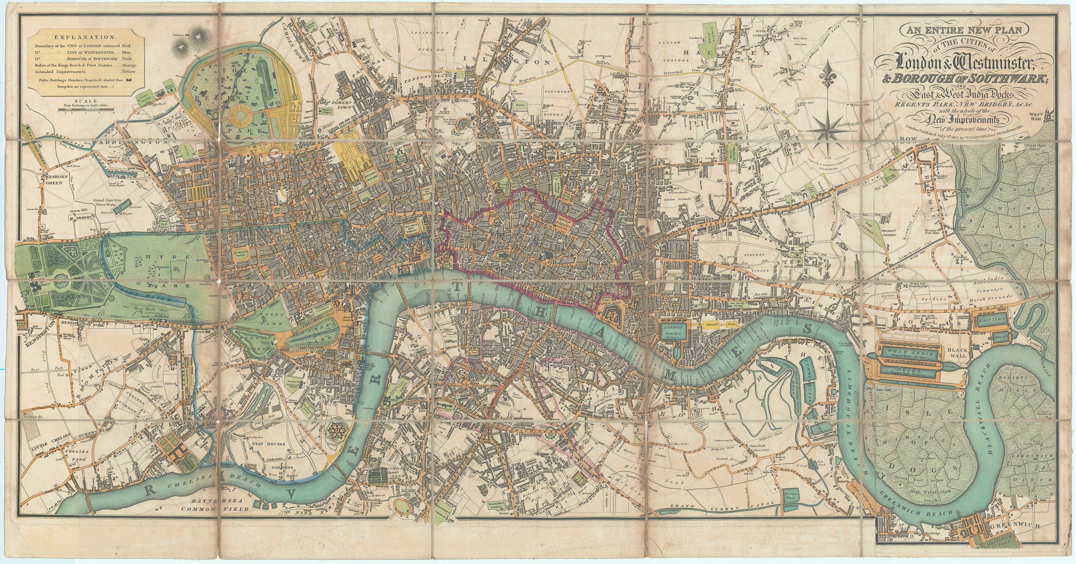
The Greatest City on Earth
Detailed map of London and the surrounding areas, covering a large area of London, including the cities of London and Westminster, the borough of Southwark, and the East and West India Docks. It also shows Regents Park, and the new bridges and other improvements that had been made in the city at the time of its publication. The map is highly detailed and shows streets, buildings, parks, and other landmarks.
The map was created at a time of rapid expansion and development in London, and it was intended to provide residents and visitors with accurate information about the city's layout and landmarks. The map was widely distributed and it was considered to be an important reference for anyone interested in the city of London.
Depicts a rapidly growing and changing city, the largest in the world at the time, with a population of over one million people. The city had undergone significant expansion in the 18th century, with many new neighborhoods and buildings being constructed. During this time, London was the center of the British Empire and a major global hub for trade, finance, and culture. Map shows many of the city's most iconic landmarks, such as Buckingham Palace, St. Paul's Cathedral, and the Houses of Parliament.
London in 1817 was a city of contrasts, a bustling metropolis with a rich history, culture and landmarks, but also with significant problems with poverty and overcrowding and inadequate infrastructure to sustain the population growth.
An important historical document, providing a detailed snapshot of London at a time of significant growth and change.
Reference:
- Howgego. The Printed Maps of London, number 268 state 2 (a).
Condition: Laid on linen as issued, short splits where old folds cross, slight worming, slight staining and offsetting