
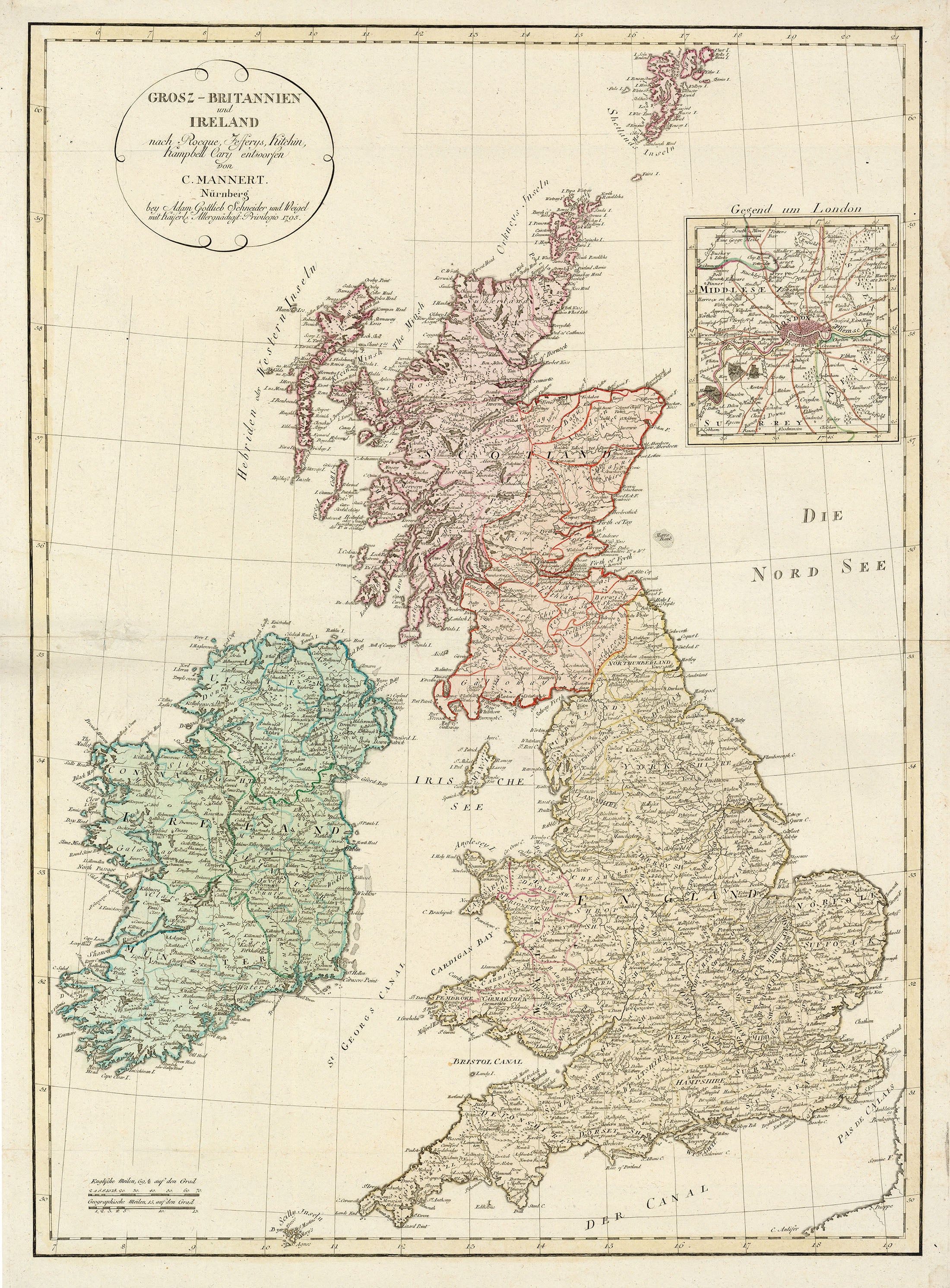
- Title: Grosz-Britannien und Ireland
- Author: Konrad Mannert
- Date: 1795
- Medium: Hand-colored copperplate engraving
- Condition: Excellent - contemporary color on a sturdy, watermarked sheet, issued folding with archival repairs to a separation at one of the fold intersections northwest of Ireland.
- Inches: 20.9 x 29 [Image]
- Centimeters: 53.09 x 73.66 [Image]
- Product ID: 317029
Grosz-Britannien und Ireland nach Rocque, Jefferys, Kitchin, Kampbell Cary entworfen von C. Mannert. Nürnberg bey Adam Gottlieb Schneider und Weigel mit Kaiserl. Allergnädigst. Privilegio 1795.
"Great Britain and Ireland after Rocque, Jefferys, Kitchin, Campbell and Cary designed by C. Mannert. Nuremberg. by Adam Gottlieb Schneider and Weigel with the Most Gracious Privilege of the King 1795."
Uncommon large format map of Great Britain showing detailed counties, towns, mountains, and rivers. Includes a large inset of the area surrounding London. The title cartouche credits the cartography to Rocque, Jefferys, Kitchin, Campbell, and Cary. A desirable example of a scarce map.
Konrad Mannert (1756-1834) was a Prussian historian and geographer born in Altdorf bei Nürnberg, where he did his studies. In 1784, he became a teacher at the Sebaldusschule in Nuremberg, and in 1788 at the Ägidiusgymnasium there. In 1796, he became professor of history at the University of Altdorf, in 1805 at the University of Würzburg, in 1807 at the Ludwig Maximilian University of Munich (then in Landshut), and from 1826 at the same university in its new location in Munich. He died in Munich in 1834. His historical work was known in particular for its focus on studying primary sources.