
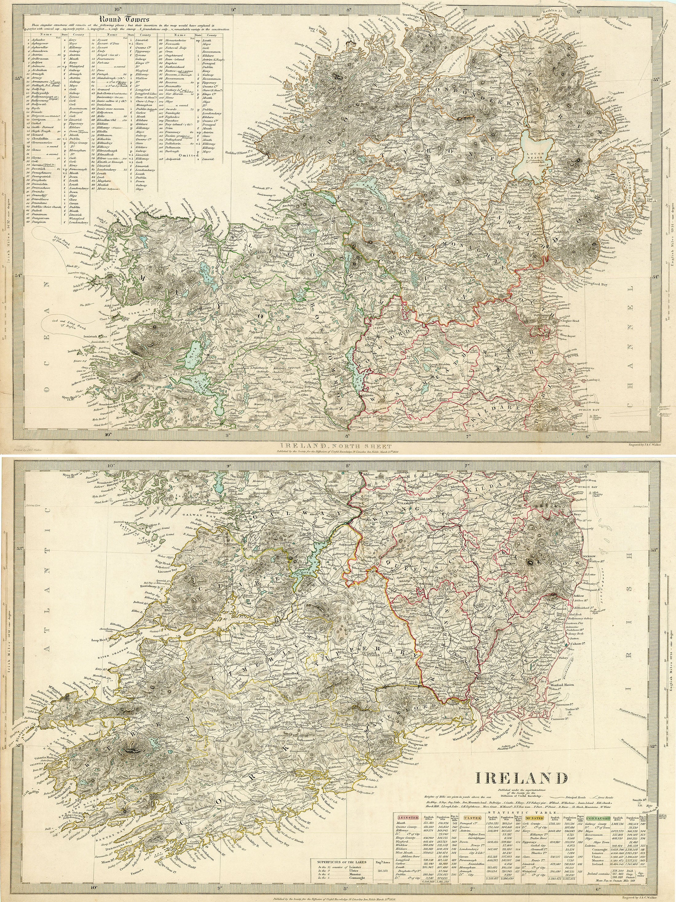

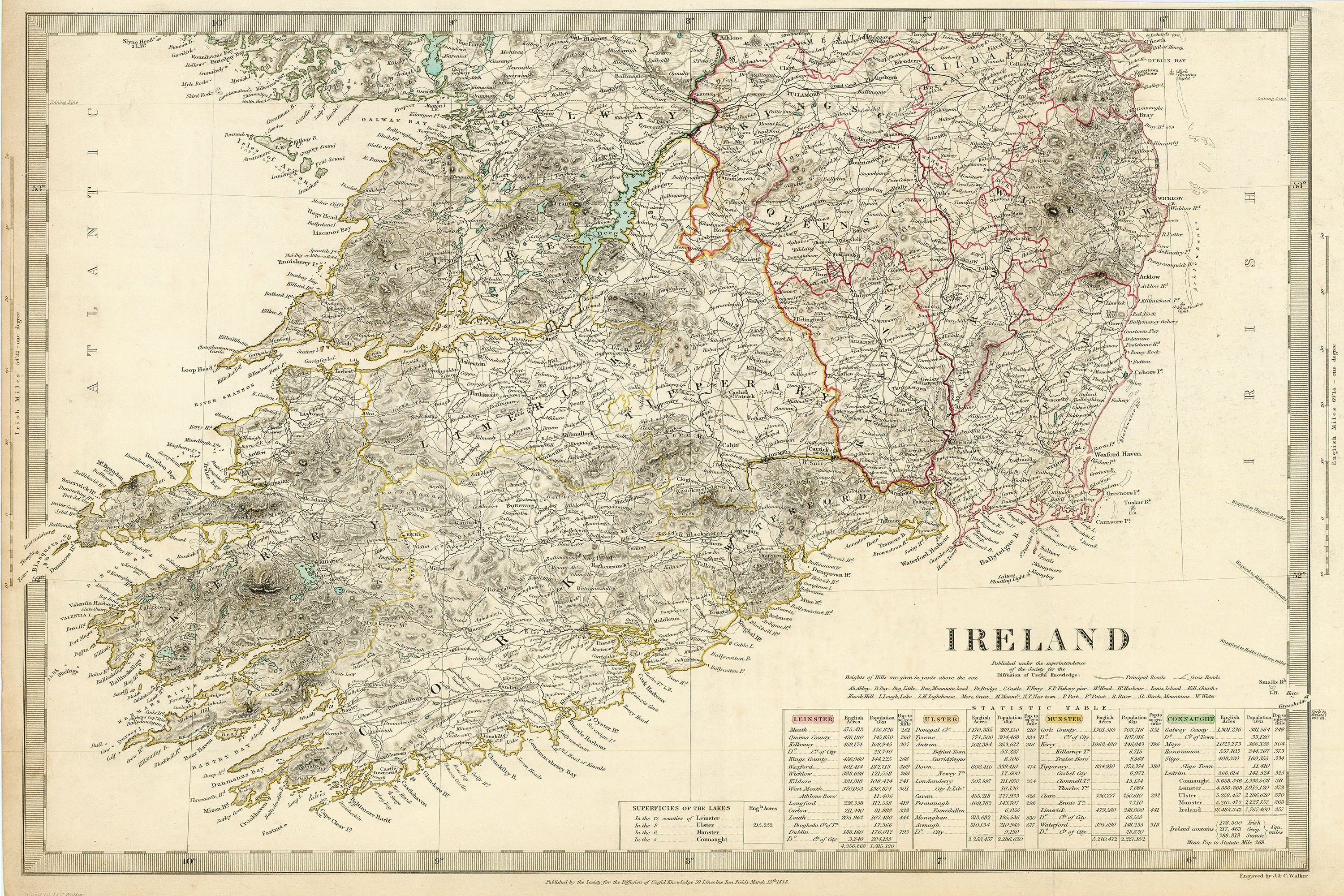
- Title: Ireland
-
Author: SDUK
- Date: 1838
- Medium: Hand-colored engraving
- Condition: Very Good - age toning, light surface dirt, trimmed margins in upper right
- Inches: 19 1/2 x 13 1/2 [Each Sheet]
- Centimeters: 49.53 x 34.29 [Each Sheet]
- Product ID: 319056
Map of Ireland published in two sheets by the Society for the Diffusion of Useful Knowledge [SDUK]. Features a statistical table along the bottom margin listing the size and population of each county. Marks the locations of abbeys, bays, mountains, bridges, castles, ferries, fisheries, harbors, islands, churches, lakes, lighthouses, ports, and rivers, among other features. In some places, map includes both Irish and English labels. A table in the top left corner lists the existing round towers in Ireland, categorized by their state of preservation ('perfect with conical cap,' 'only the stump,' etc.).