
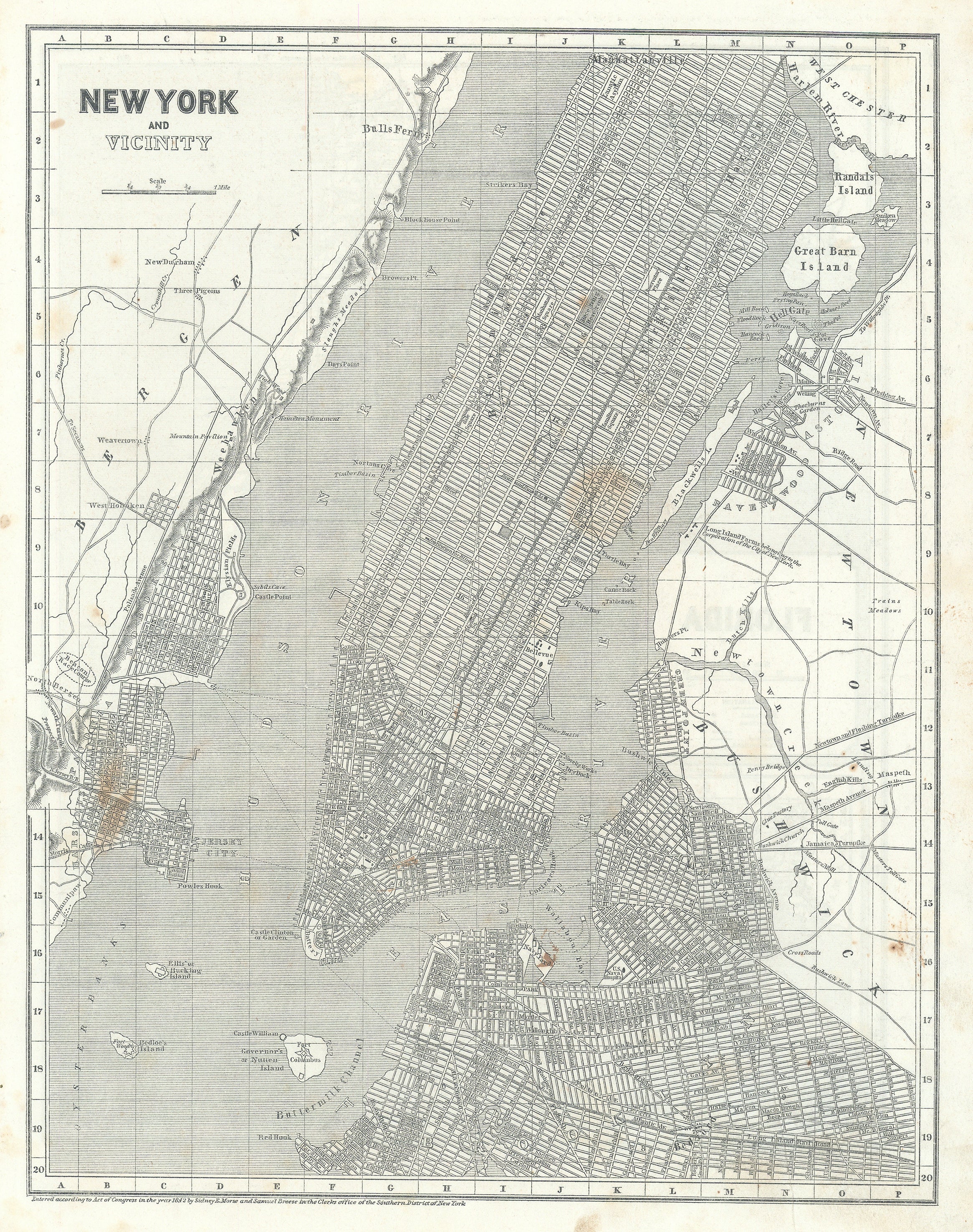
- Title: New York City and Vicinity
- Author: Sidney Edwards Morse
- Date: 1842
- Medium: Lithograph
- Condition: Fair, on thin wavy paper, scattered stains, mild age toning. Edge wear with soiling and evidence of stab binding.
- Inches: 16 1/4 x 13" [Paper]
- Centimeters: 41.27 x 33.02 [Paper]
- Product ID: 308074
This map of New York City was first issued in a three part supplement published from 1842-1845, as the Cerographic Atlas of the United States. The present map is from the 1842 supplement, with Florida state on the verso. Shows the City from the Battery to 133rd Street north. Extensive detail for Brooklyn east to Sarartoga street, south to just below the Long Island Railroad, and the historic neighborhoods of Greenspoint, Ravenswood and Astoria. Bushwick and Newtown with lesser detail, showing turnpike roads, bridges and tolls but few streets. Jersey City, Hoboken, Harsimus and Pavonia (the first European settlement on the west bank of the Hudson River). with street level detail.
Sidney Edwards Morse (1794 – 1871) was an American geographer, journalist, and inventor. He shared his innovative spirit with his brother, Samuel F.B. Morse, and his father Jedidiah Morse, who published the first geography book in the United States in 1784. He was born in Charlestown, Massachusetts, graduated from Yale College at fourteen, studied theology at Andover and law at Litchfield, and at sixteen began writing for a Boston newspaper. In 1823 he and his brother Richard established the New York Observer, which was widely hailed the foremost religious paper in the country at the time. Morse took an active interest in science, geography and exploration. He was among the earliest to use the printing process known wax engraving, or cerography, for which he received the U.S. patent.
His best-known works are A New System of Modern Geography (1823), the North American Atlas, the Bible Atlas, and a series of general maps. For several years the sales of the two first- mentioned works averaged 70,000 copies annually, and more than 500,000 copies of his System of Modern Geography were printed.
Reference: New-York as it is : containing a general description of the City of New-York…; 1833, Tanner (from the Internet Archive, https://archive.org/, accessed 7-1-2022)
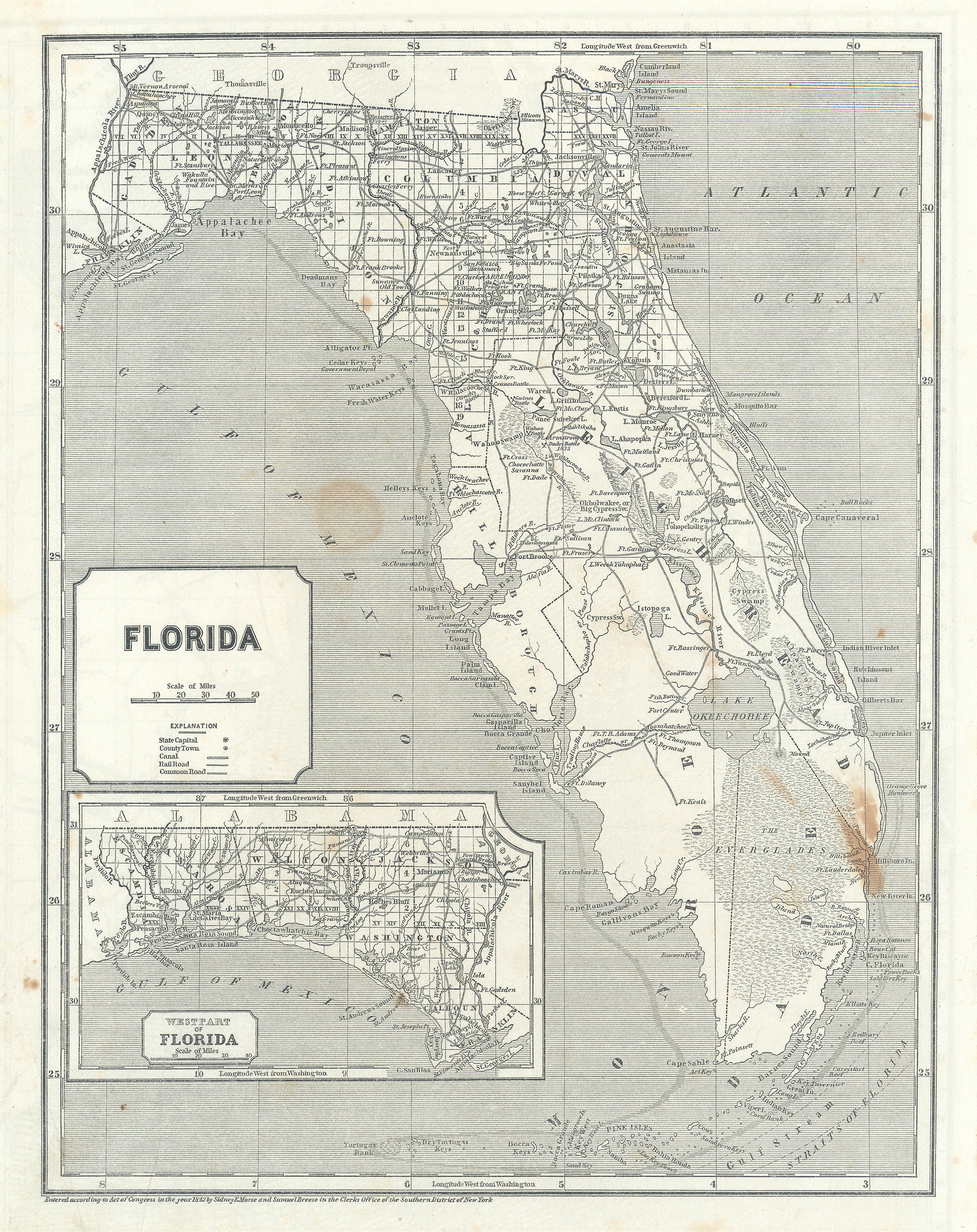
Verso: [State of] FLORIDA