
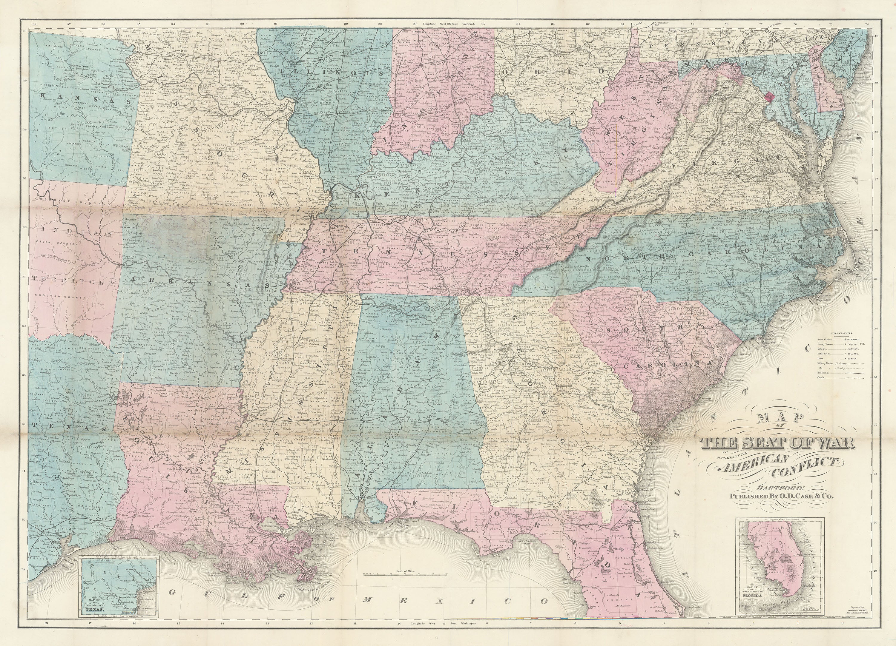
- Title: Map of the Seat of War to Accompany the American Conflict
- Author: O. D. Case & Co.
- Date: 1866
- Medium: Hand-colored lithograph
- Condition: Very Good Plus - age toning, wear and discoloration along fold lines
- Inches: 38 3/4 x 28 1/8 [Paper]
- Centimeters: 98.43 x 71.44 [Paper]
- Product ID: 233107
Map of the Southern United States published immediately after the Civil War. Features two inset maps along the lower border: Map of the Lower Portion of Texas and Map of the Lower Portion of Florida. A legend to the right of the map explains the symbols used to indicate State Capitals, County Towns, Villages, Battle Fields, Forts, Military Routes [Infantry and Cavalry], Rail Roads, and Canals. Map features Louisiana, Arkansas, Alabama, Mississippi, Georgia, North and South Carolina, Virginia, West Virginia, Maryland, Delaware, Tennessee, Kentucky, and parts of Kansas, Indian Territory [Oklahoma], Pennsylvania, New Jersey, Ohio, Indiana, Illinois, and Missouri. Washington, D. C. is marked with a red diamond. Longitude from the Greenwich and Washington Meridians.