
- Title: Alaska
- Author: Kroll Map Company
- Date: 1939
- Medium: Chromolithograph
- Condition: Good - age toning, fragile at issued folds, original paperback binding
- Inches: 46 x 32 1/2 [Paper]
- Centimeters: 116.84 x 82.55 [Paper]
- Product ID: 317066
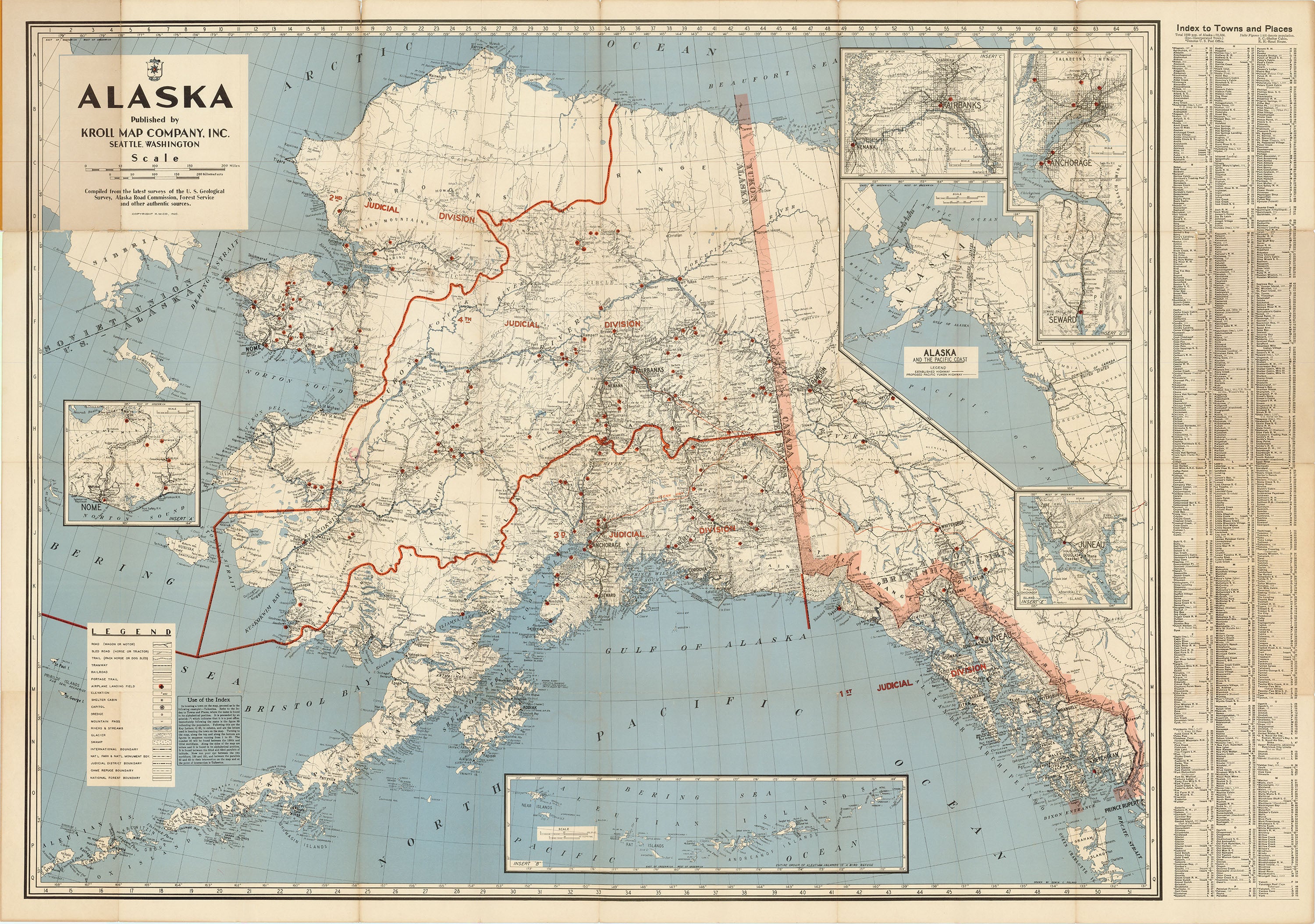
Alaska
Published by
Kroll Map Company, Inc.
Seattle, Washington
Compiled from the latest surveys of the U. S. Geological
Survey, Alaska Road Commission, Forest Service
and other authentic sources.
Map of Alaska published in Seattle by the Kroll Map Company. Shows the U.S.-Soviet boundary and contains insets showing the cities of Nome, Juneau, Seward, Anchorage, and Fairbanks with their environs, as well as the Aleutian Islands. Another inset along the right-hand margin is titled 'Alaska and the Pacific Coast' showing highways and proposed highways. Map divides the territory into Judicial Divisions and includes parts of British Columbia, Yukon, and Siberia. An index to the right of the map lists various towns and places in the region.
Legend in the lower left corner:
Road (Wagon or Motor)
Sled Road (Horse or Tractor)
Trail (Pack Horse or Dog Sled)
Tramway
Railroad,
Portage Trail
Airplane Landing Field
Elevation
Shelter Cabin
Capitol
Dredge
Mountain Pass
Rivers & Streams
Glacier
Swamp
International Boundary
Natl Park & Natl Monument Bdy.
Judicial District Boundary
Game Refuge Boundary
National Forest Boundary