
- Title: La Florida, Guastecan, Peruviæ Auriferæ Regionis Typus
- Author: Abraham Ortelius
- Date: 1598
- Medium: Copperplate engraving
- Condition: Nicely margined and well inked, evenly age toned, marginal tide marking, dust soiling, a few unobtrusive stains. A very good example.
- Inches: 13 7/8 x 18 1/4 [Image]
- Centimeters: 35.24 x 46.36 [Image]
- Product ID: 315098
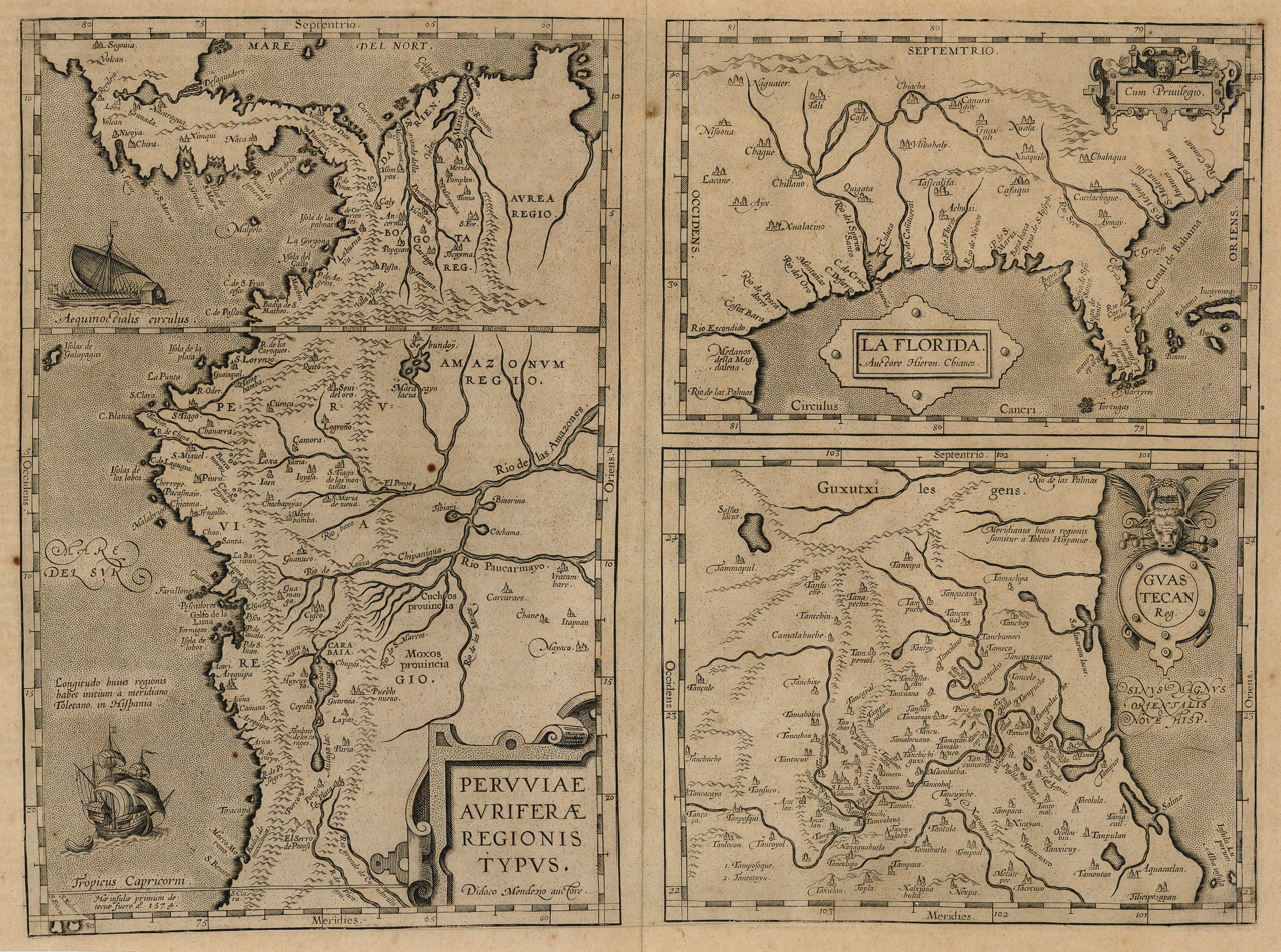
La Florida, published by Ortelius in his Theatrum of 1584, was designed for Ortelius by the Spanish geographer Gerónimo de Chavez. Chavez, a pilot and noted scientist, was successor to Sebastian Cabot as chair of cartography for la Casa de Contratación, the Spanish clearinghouse for new information concerning the Americas. He was also cosmographer to Philip II, who at the time ruled not only Spain, but also the Netherlands. With access to all official reports from the Spanish explorers, Chavez's map recorded the discoveries of Cabeza de Vaca, De Soto, and Moscoso.
Abraham Ortelius was born in 1527, spending his early working years as a map colorist, which led him into other businesses requiring extensive travel. His association with Dutch businessman and entrepreneur Gilles Hoffman provided an introduction to the influential and prolific publisher Christopher Plantin and the brilliant Gerard Mercator. Mercator was, of course, one of the most talented and exacting cartographers of the time. With increasing demand for accurate maps from commercial enterprises, Ortelius decided to assemble the best available maps, rework them into a standardized size and format, and issue them (with appropriate credit to the authors) as one new atlas, the Theatrum Orbis Terrarium. This effort, later described as the “world’s first atlas,” was met with immediate and considerable popularity, creating an entirely new offering for the map trade and propelling Ortelius into the first rank of commercial cartographers/ compilers.