
- Title: Map of the Original Thirteen Colonies
- Author: Augustus Mitchell
- Date: 1881
- Medium: Hand-colored lithograph
- Condition: Excellent - light age toning
- Inches: 15 1/4 x 12 3/8 [Paper]
- Centimeters: 38.74 x 31.43 [Paper]
- Product ID: 101282
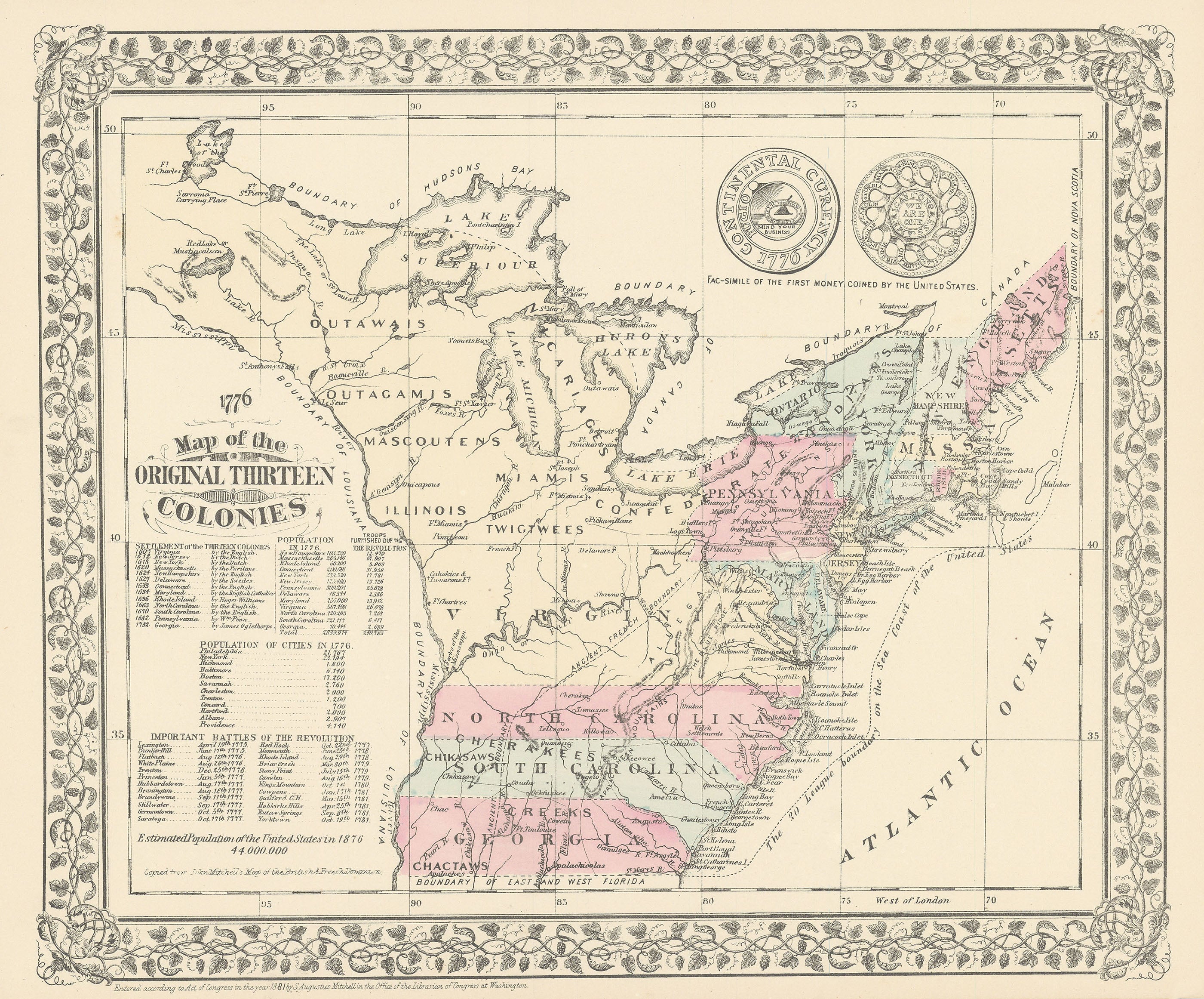
Map of the thirteen colonies of the United States: Georgia, South and North Carolina, Maryland, Virginia, Pennsylvania, Delaware, New Jersey, New York, Massachusetts, New Hampshire, Connecticut, and Rhode Island. Map labels the locations of Native peoples and provides data about the colonies such as their populations at the time and the number of troops furnished by each for the Revolution. Other information offered includes important Revolutionary battles and their dates, as well as the U.S.'s total population at the time of its centennial in 1876. The Mississippi River marks the colonies' boundary with Louisiana to the west, and off the Atlantic coastline a dotted line marks 'The 30 League boundary on the Sea Coast of the United States.' To the upper right, Mitchell includes images showing a 'Fac-Simile of the First Money Coined by the United States.'