
Collection: Sea & Aeronautical Charts
Antique sea and aeronautical charts from the sixteenth through twentieth centuries.
-
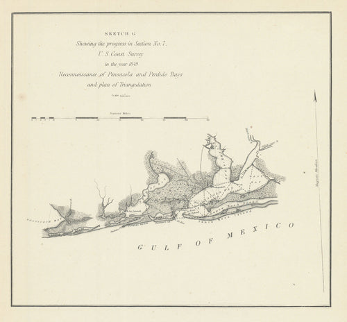
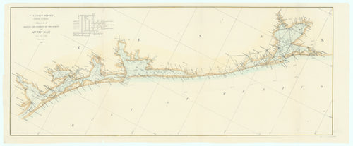
Reconnoissance of Pensacola and Perdido Bays: Bache 1849
![Old map of Pensacola Bay, Florida]()
- Regular price
- $55.00
- Sale price
- $55.00
- Regular price
-
- Unit price
- per
Sold -
Yslandt in Het Groot...: Van Keulen II, c.1753
![]()

- Regular price
- $4,995.00
- Sale price
- $4,995.00
- Regular price
-
- Unit price
- per
Sold -
Preliminary Survey of the Entrance to the Rio Grande, Texas: Bache 1854
![]()

- Regular price
- $595.00
- Sale price
- $595.00
- Regular price
-
- Unit price
- per
Sold -
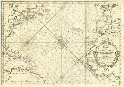
Carte de l'Ocean Occidental: Bellin 1746
![Old map of the Atlantic Ocean]()
- Regular price
- $345.00
- Sale price
- $345.00
- Regular price
-
- Unit price
- per
Sold -
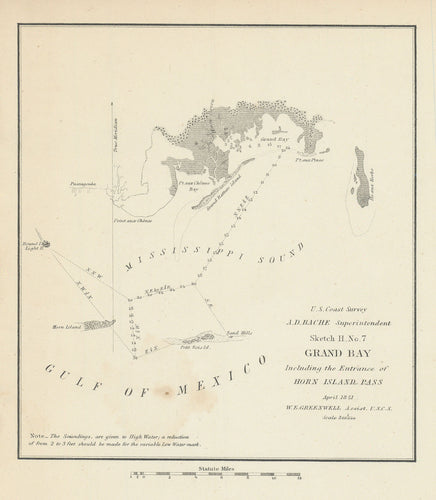
Grand Bay Including the Entrance of Horn Island Pass: Bache 1851
![Old map of the Mississippi Sound]()
- Regular price
- $55.00
- Sale price
- $55.00
- Regular price
-
- Unit price
- per
Sold -
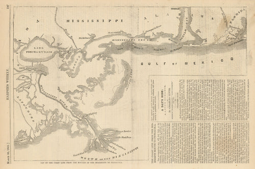
Map of the Coast Line from the Mouths of the Mississippi to Pensacola: Harper's Weekly 1861
![Old map of the mouth of the Mississippi]()
- Regular price
- $145.00
- Sale price
- $145.00
- Regular price
-
- Unit price
- per
Sold -
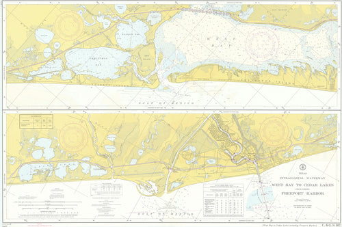
Texas Intracoastal Waterway West Bay to Cedar Lakes Including Freeport Harbor: U. S. Coast and Geodetic Survey 1964
![Old map of the Texas Intracoastal Waterway]()
- Regular price
- $395.00
- Sale price
- $395.00
- Regular price
-
- Unit price
- per
Sold -
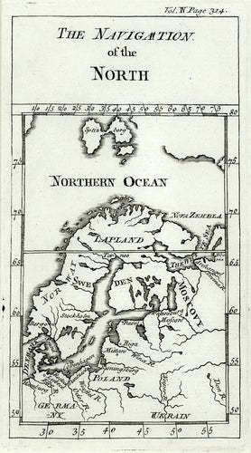
The Navigation of the North: De Freval 1738
![Old map of northern Europe]()
- Regular price
- $95.00
- Sale price
- $95.00
- Regular price
-
- Unit price
- per
Sold -
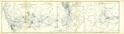
Progress of the Transcontinental Triangulation and Reconnaissance Eastward from the Pacific Coast: U.S. Coast and Geodetic Survey 1887
![Old map of the western United States]()
- Regular price
- $75.00
- Sale price
- $75.00
- Regular price
-
- Unit price
- per
Sold -
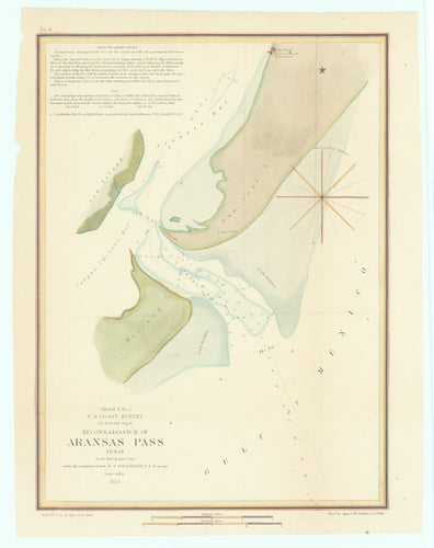
Reconnaissance of Aransas Pass Texas: Bache 1853
![]()
- Regular price
- $395.00
- Sale price
- $395.00
- Regular price
-
- Unit price
- per
Sold -
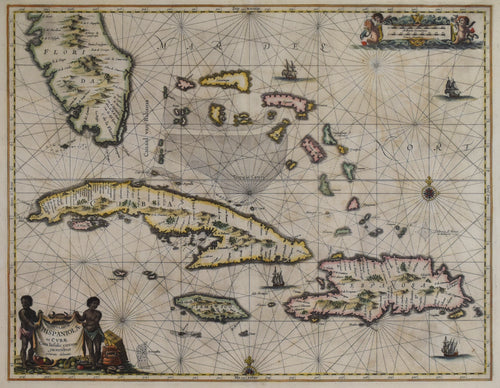
Sea Chart of the Greater Antilles: Jan Jansson 1650
![]()
- Regular price
- $2,895.00
- Sale price
- $2,895.00
- Regular price
-
- Unit price
- per
Sold -
Paths of West Indian Hurricanes for 46 years: Cravens, Darqan & Co., 1933
![]()

- Regular price
- $595.00
- Sale price
- $595.00
- Regular price
-
- Unit price
- per
Sold -
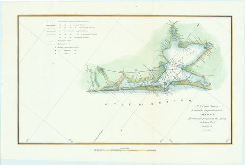
Sketch I (Matagorda Bay to Sabine Pass): Bache 1848-53
![]()

- Regular price
- $695.00
- Sale price
- $695.00
- Regular price
-
- Unit price
- per
Sold -
Sportsmens' Map Co. Houston, Texas Galveston: A. Graham Scott and Emmett R. Ramsey, 1946
![]()

- Regular price
- $695.00
- Sale price
- $695.00
- Regular price
-
- Unit price
- per
Sold -
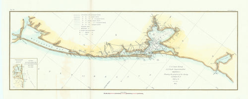
Sketch I Showing the Progress of the Survey in Section No. IX (Galveston Bay to Corpus Christi Bay): Bache, 1861
![]()

- Regular price
- $695.00
- Sale price
- $695.00
- Regular price
-
- Unit price
- per
Sold -
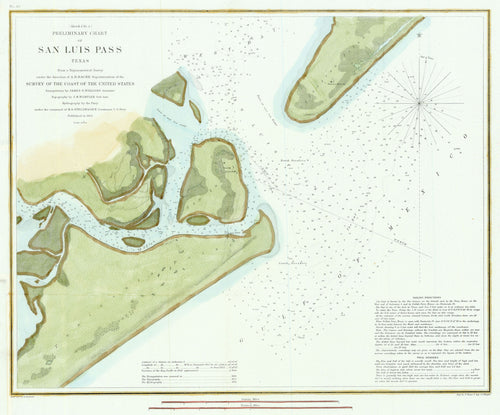
Preliminary Chart of San Luis Pass Texas: Bache 1853
![]()

- Regular price
- $495.00
- Sale price
- $495.00
- Regular price
-
- Unit price
- per
Sold -
Nieuwe wassende zee caart van de Noord-Oceaen...: Van Keulen II, 1745
![]()

- Regular price
- $7,995.00
- Sale price
- $7,995.00
- Regular price
-
- Unit price
- per
Sold -
Sketch I (Matagorda Bay to Sabine Pass): Bache 1848-53
![]()

- Regular price
- $695.00
- Sale price
- $695.00
- Regular price
-
- Unit price
- per
Sold -
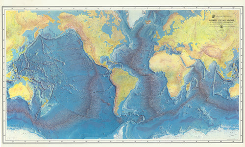
World Ocean Floor: Heezen & Tharp, 1977
![Map of the worlds oceans]()
- Regular price
- $2,495.00
- Sale price
- $2,495.00
- Regular price
-
- Unit price
- per
Sold -
Sketch I Showing the Progress of the Survey in Section No. IX [Galveston Bay to Corpus Christi Bay], Bache 1866
![]()
- Regular price
- $795.00
- Sale price
- $795.00
- Regular price
-
- Unit price
- per
Sold -
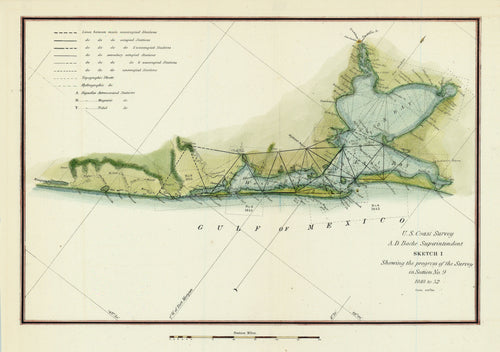
Sketch I Showing the Progress of the Survey in Section No. 9 [Galveston Bay]: Bache 1851
![]()
- Regular price
- $595.00
- Sale price
- $595.00
- Regular price
-
- Unit price
- per
Sold -
Sketch I (Matagorda Bay to Sabine Pass): Bache 1854
![]()
- Regular price
- $695.00
- Sale price
- $695.00
- Regular price
-
- Unit price
- per
Sold -
Sketch I Showing the Progress of the Survey in Section No. 9 [Galveston Bay]: Bache 1852
![Old map of Galveston Bay, Texas]()
- Regular price
- $595.00
- Sale price
- $595.00
- Regular price
-
- Unit price
- per
Sold -
Preliminary Chart of San Luis Pass Texas: Bache 1853
![Old map of San Luis Pass, Texas]()
- Regular price
- $595.00
- Sale price
- $595.00
- Regular price
-
- Unit price
- per
Sold -
Indexed City Map of Baytown, Texas and Galveston Bay Area Fishing Guide: U. S. Dept. of Commerce c. 1962
![Old fishing guide to Galveston Bay, Texas]()
- Regular price
- $595.00
- Sale price
- $595.00
- Regular price
-
- Unit price
- per
Sold -
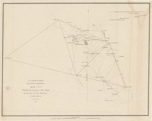
Bay of San Francisco California: Bache 1851
![Old map of San Francisco Bay]()
- Regular price
- $275.00
- Sale price
- $275.00
- Regular price
-
- Unit price
- per
Sold -
Sabine Bank to East Bay Including Heald Bank: U. S. Coast and Geodetic Survey 1945
![Old map of the Gulf Coast]()

- Regular price
- $295.00
- Sale price
- $295.00
- Regular price
-
- Unit price
- per
Sold -
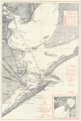
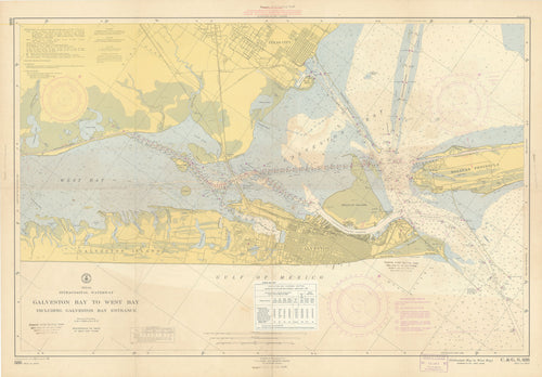
Texas Intracoastal Waterway Galveston Bay to West Bay Including Galveston Bay Entrance: U. S. Coast and Geodetic Survey 1957
![Old map of Galveston Island]()
- Regular price
- $450.00
- Sale price
- $450.00
- Regular price
-
- Unit price
- per
Sold -
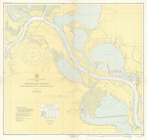
Houston Ship Channel Alexander Island to Carpenter Bayou: U. S. Coast and Geodetic Survey 1951
![Old map of the Houston Ship Channel]()
- Regular price
- $295.00
- Sale price
- $295.00
- Regular price
-
- Unit price
- per
Sold -
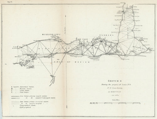
Sketch H [Mississippi and Alabama Gulf Coast]: Bache c. 1849
![Old map of the Mississippi Sound]()
- Regular price
- $95.00
- Sale price
- $95.00
- Regular price
-
- Unit price
- per
Sold -
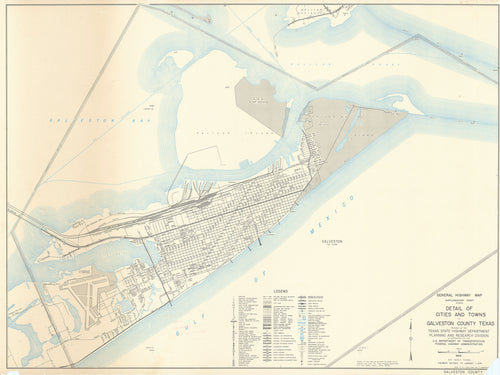
Detail of Cities and Towns in Galveston County Texas: Texas State Highway Department 1974
![Old map of Galveston, Texas]()
- Regular price
- $595.00
- Sale price
- $595.00
- Regular price
-
- Unit price
- per
Sold -
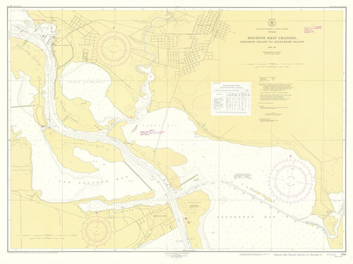
Houston Ship Channel Atkinson Island to Alexander Island: U. S. Coast and Geodetic Survey 1951
![Old map of the Houston Ship Channel]()
- Regular price
- $295.00
- Sale price
- $295.00
- Regular price
-
- Unit price
- per
Sold


- Page 1 of 2
- Next page