
- Title: Hill Co.
- Author: Texas General Land Office
- Date: ca. 1925
- Medium: Lithograph
- Condition: Excellent
- Inches: 14 x 17 [Paper]
- Centimeters: 35.56 x 43.18 [Paper]
- Product ID: 3112124
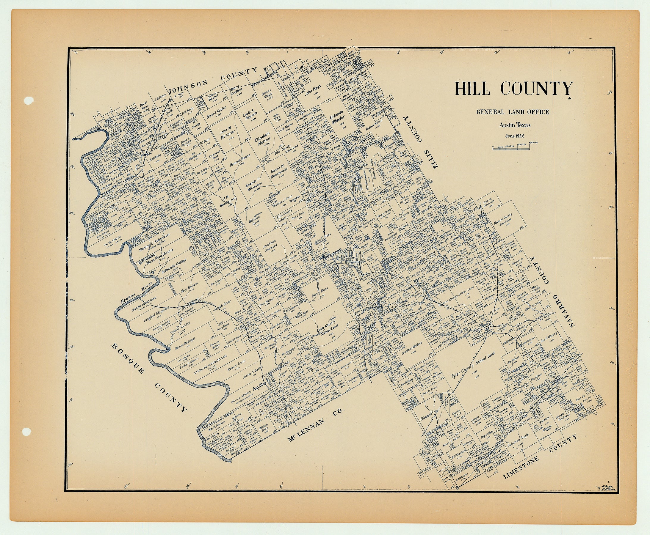
Antique Texas county map published ca. 1925 by Wolf & Bennett for the Texas General Land Office. General Land Office maps show land patents, block and tract numbers, landowners, towns, railroads, and portions of adjacent counties where property boundaries extend beyond county limits.
This map shows Hill County, est. 1853. The county seat of Hillsboro is shown near the center, at the junction of the Missouri, Kansas & Texas Railroad, and the Trinity & Brazos Valley Railroad. The county is traversed by several other railways, including the International & Great Northern and Texas & St. Louis Narrow Gauge Railroad in the southeast, the Texas Central Railroad in the Southwest, and the Gulf Colorado and Santa Fe Railroad in the Northwest. Hill County’s western border with Bosque County is defined by the Brazos River, while Johnson, Ellis, Navarro, Limestone and McLennan counties border on the north, east and south.
Survey date – 1922
Condition Notes:
- Uniform age toning, a bit darker along edges, paper somewhat fragile, original binding holes present.
- Excellent overall condition.