
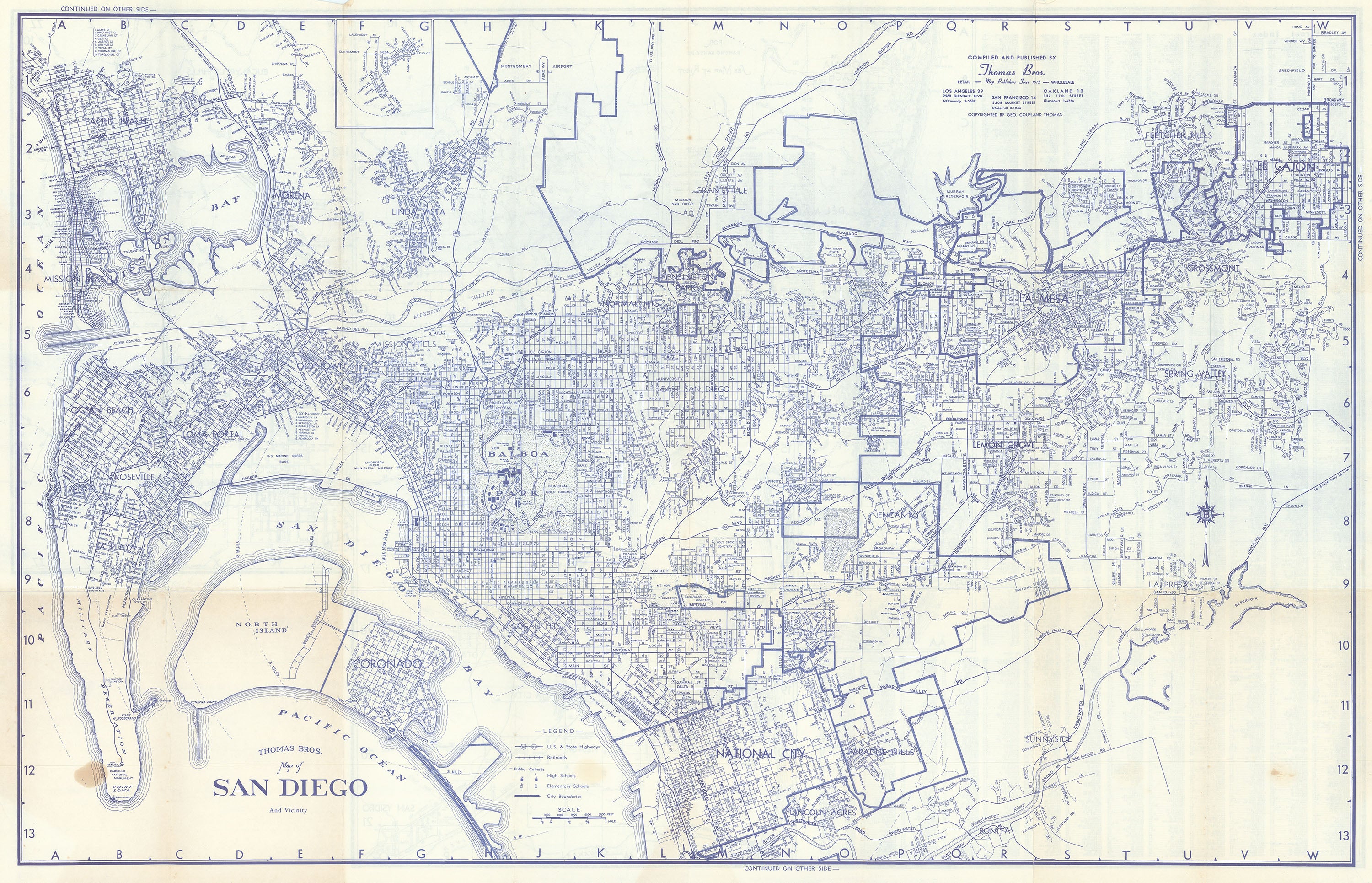


- Title: Map of San Diego and Vicinity
- Author: Thomas Bros.
- Date: c. 1940
- Medium: Printed
- Condition: Very Good - age toning and areas of discoloration, issued folding
- Inches: 33 3/4 x 22 [Paper]
- Centimeters: 85.73 x 55.88 [Paper]
- Product ID: 318096
Folding map of San Diego, California and environs. Features San Diego Bay, Mission Bay, Balboa Park, Coronado Beach, and the U. S. Marine base. A legend marks U. S. and state highways, railroads, schools, and city limits. Verso contains inset maps of Chula Vista, La Jolla, El Cajon, San Ysidro, Solana Beach, Rancho Santa Fe, and other cities and towns in the area.
The Thomas Brothers, founders of Thomas Bros. Maps, were influential mapmakers whose work became a staple of navigation and urban planning in California around 1940. The company was established in 1915 in Oakland, California, by George Coupland Thomas and his brothers. By the late 1930s and into the 1940s, their detailed street maps and atlases had become widely used throughout California, especially in major cities like Los Angeles, San Diego, San Francisco, and San Jose. Their products were known for their accuracy, comprehensive street indexes, and user-friendly fold-out designs, making them invaluable for residents, businesses, and government agencies.