
Collection: United States
A collection of antique maps depicting the fifty United States, colonial North America, and Indian Territories. Includes pieces sourced from atlases produced by cartographers such as Asher & Adams, Alvin J. Johnson (A. J. Johnson), J. H. Colton & Co, Augustus Mitchell, Tunison, Rand, McNally & Co, Funt & Eaton, George Cram, Smith, the U.S. Geological Survey, and others.
-
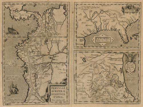
La Florida, Guastecan, Peruviæ Auriferæ Regionis Typus: Ortelius 1598
![Old map of the Gulf of Mexico, Mexico, and South America]()
- Regular price
- $2,100.00
- Sale price
- $2,100.00
- Regular price
-
- Unit price
- per
Sold -
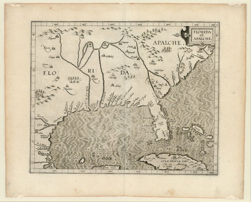
Florida et Apalche: Wytfliet 1597
![Old map of the Gulf of Mexico]()
- Regular price
- $4,750.00
- Sale price
- $4,750.00
- Regular price
-
- Unit price
- per
Sold


