
- Title: Plan de la Nouvelle Orleans
- Author: Jacques Nicolas Bellin
- Date: 1764
- Medium: Copperplate engraving
- Condition: See description
- Inches: 11.6 x 8.1 [Image]
- Centimeters: 29.46 x 20.57 [Image]
- Product ID: 308089
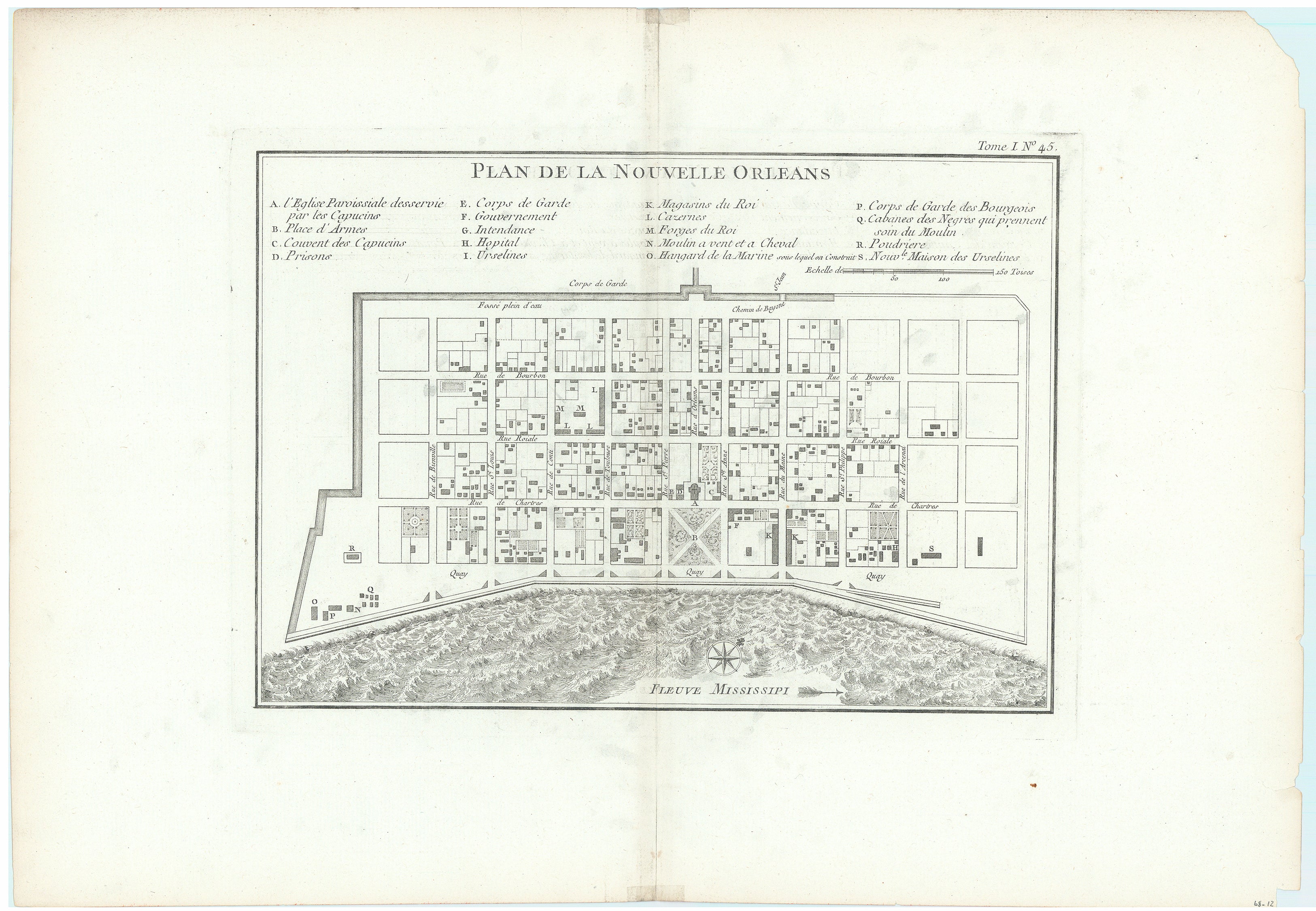
Deluxe Version of Bellin’s Plan of New Orleans
Extensively detailed early plan detailing colonial New Orleans during French rule. Oriented to the northwest at top, scale in French Toises. Shows Bourbon Street, houses, gardens, etc. Key with reference to 18 locations at top, including the Parish Church, municipal buildings, barracks, a powder magazine, a brick kiln, and Ursuline Academy, the hospital, a monastery, and Army and Navy quarters, among its many details. With one gate leading into the city from the north to Bayone St Jean.
Bellin's plan was first issued in Charlevoix's History and General Description of New France, in 1742 with later versions, such as this, used in several publications. The plan became the standard map of New Orleans throughout the eighteenth century.
Condition:
On watermarked paper with extra large margins from a deluxe version of Bellins Petit Atlas Maritime. Light toning along the centerfold and sheet edges. A short centerfold separation confined to the bottom blank margin has been closed on verso with archival tape, marginal chipping.
References: Sellers and Van Ee #1676