
Collection: United States
A collection of antique maps depicting the fifty United States, colonial North America, and Indian Territories. Includes pieces sourced from atlases produced by cartographers such as Asher & Adams, Alvin J. Johnson (A. J. Johnson), J. H. Colton & Co, Augustus Mitchell, Tunison, Rand, McNally & Co, Funt & Eaton, George Cram, Smith, the U.S. Geological Survey, and others.
-
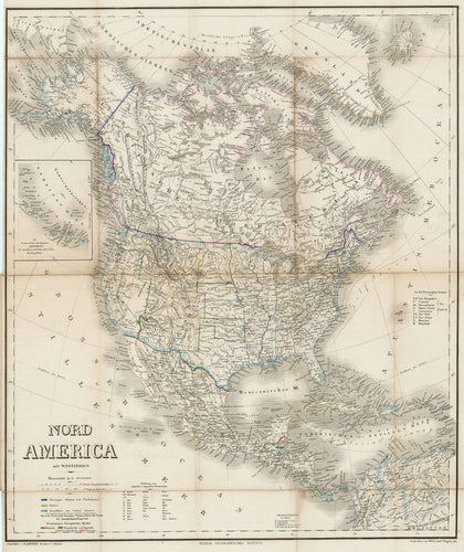
Nord America mit Westindien: Kiepert c. 1870
![Old map of North America]()
- Regular price
- $195.00
- Sale price
- $195.00
- Regular price
-
- Unit price
- per
Sold -
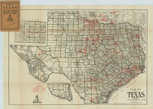
Gallup's Map of Texas: Gallup c. 1922
![Old oil map of Texas]()
- Regular price
- $2,500.00
- Sale price
- $2,500.00
- Regular price
-
- Unit price
- per
Sold -
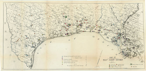
Map of Gulf Coast District: c. 1928 - The Mother Map to the Oil and Gas Journal Gulf Coast Map Series, from the papers of the founder of TEXACO
![Old oil map of Texas and the Gulf Coast]()
- Regular price
- $9,500.00
- Sale price
- $9,500.00
- Regular price
-
- Unit price
- per
Sold -
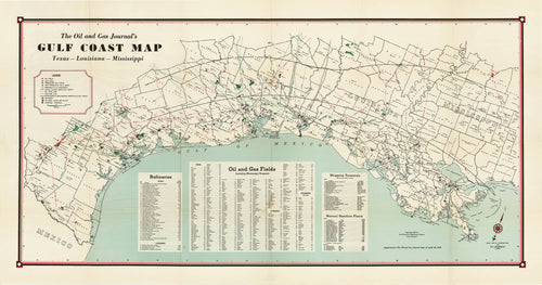
The Oil and Gas Journal's Gulf Coast Map: The Petroleum Publishing Company 1939
![Old oil map of the Gulf Coast]()
- Regular price
- $2,900.00
- Sale price
- $2,900.00
- Regular price
-
- Unit price
- per
Sold -
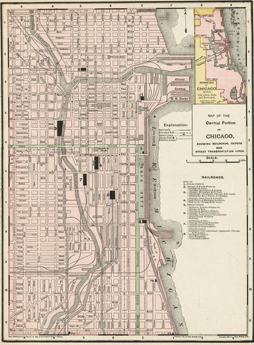
Map of the Central Portion of Chicago: Rand, McNally & Co. 1895
![Old map of Chicago, IL]()
- Regular price
- $75.00
- Sale price
- $75.00
- Regular price
-
- Unit price
- per
Sold -
California: Rand, McNally & Co. 1895
![Old map of California]()

- Regular price
- $75.00
- Sale price
- $75.00
- Regular price
-
- Unit price
- per
Sold -
Map of the Main Portion of San Francisco: Rand, McNally & Co. 1895
![old map of San Francisco, California]()

- Regular price
- $75.00
- Sale price
- $75.00
- Regular price
-
- Unit price
- per
Sold -
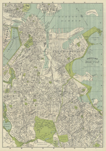
Indexed Map of Boston: Walker Lithographic & Publishing Co. c. 1910
![Old map of Boston]()
- Regular price
- $200.00
- Sale price
- $200.00
- Regular price
-
- Unit price
- per
Sold -
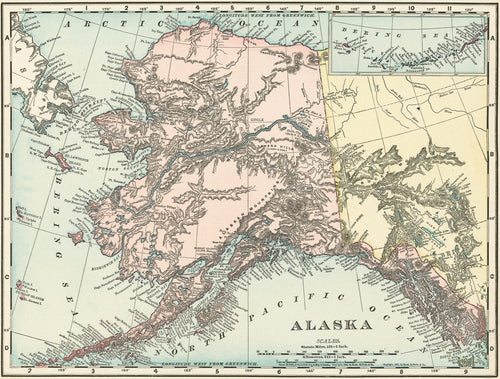
Alaska: Rand, McNally & Co. 1895
![Old map of Alaska]()
- Regular price
- $50.00
- Sale price
- $50.00
- Regular price
-
- Unit price
- per
Sold -
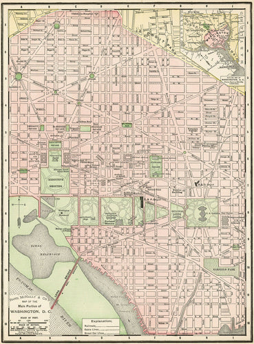
Map of the Main Portion of Washington, D. C.: Rand, McNally & Co. 1895
![Old map of Washington, D. C.]()
- Regular price
- $75.00
- Sale price
- $75.00
- Regular price
-
- Unit price
- per
Sold -
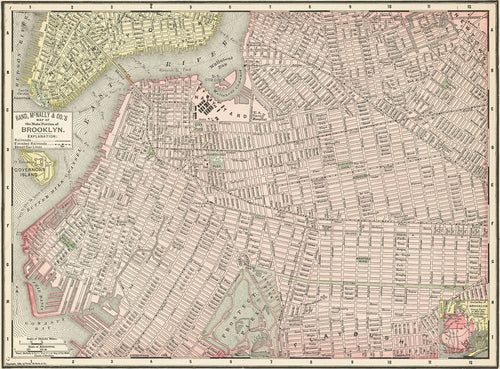
Map of the Main Portion of Brooklyn: Rand, McNally & Co. 1895
![Old map of Brooklyn, New York]()
- Regular price
- $75.00
- Sale price
- $75.00
- Regular price
-
- Unit price
- per
Sold -
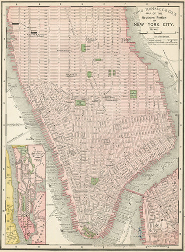
Map of the Southern Portion of New York City: Rand, McNally & Co. 1895
![Old map of New York City]()
- Regular price
- $75.00
- Sale price
- $75.00
- Regular price
-
- Unit price
- per
Sold -
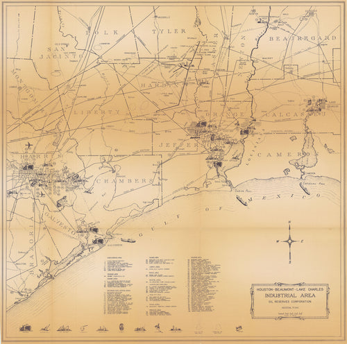
Houston - Beaumont - Lake Charles Industrial Area: Oil Reserves Corporation c. 1962
![Old industrial map of the Texas Gulf Coast]()
- Regular price
- $750.00
- Sale price
- $750.00
- Regular price
-
- Unit price
- per
Sold -
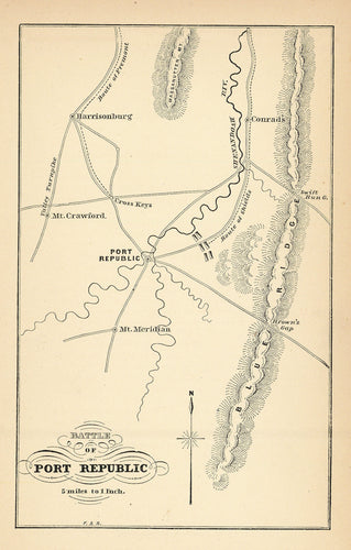
Battle of Port Republic: c. 1890
![Old Civil War map of the Battle of Port Republic]()
- Regular price
- $75.00
- Sale price
- $75.00
- Regular price
-
- Unit price
- per
Sold -
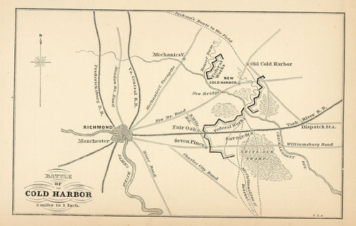
Battle of Cold Harbor: c. 1890
![Old Civil War map of the Battle of Cold Harbor]()
- Regular price
- $75.00
- Sale price
- $75.00
- Regular price
-
- Unit price
- per
Sold -
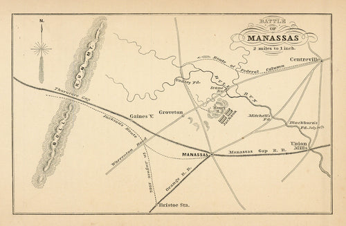
Battle of Manassas: c. 1890
![Old Civil War map of the Battle of Manassas]()
- Regular price
- $75.00
- Sale price
- $75.00
- Regular price
-
- Unit price
- per
Sold -
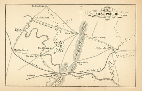
Battle of Sharpsburg: c. 1890
![Old Civil War map of the Battle of Sharpsburg]()
- Regular price
- $75.00
- Sale price
- $75.00
- Regular price
-
- Unit price
- per
Sold -
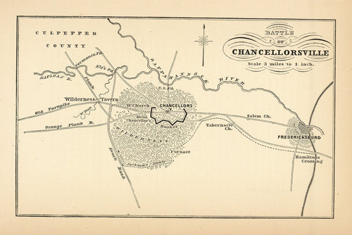
Battle of Chancellorsville: c. 1890
![Old Civil War map of the Battle of Chancellorsville]()
- Regular price
- $75.00
- Sale price
- $75.00
- Regular price
-
- Unit price
- per
Sold -
Map of Los Angeles: Violé 1904
![Old map of Los Angeles, California]()

- Regular price
- $595.00
- Sale price
- $595.00
- Regular price
-
- Unit price
- per
Sold -
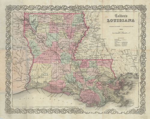
Colton's Louisiana: Colton 1864
![]()
- Regular price
- $250.00
- Sale price
- $250.00
- Regular price
-
- Unit price
- per
Sold -
Map of San Diego and Vicinity: Thomas Bros. c. 1940
![Old map of San Diego, California]()

- Regular price
- $150.00
- Sale price
- $150.00
- Regular price
-
- Unit price
- per
Sold -
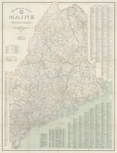
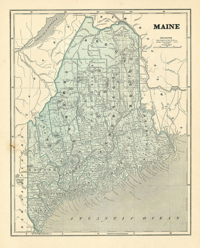
The Official Map of Maine: The National Survey Co. 1915
![Old map of Maine]()
- Regular price
- $195.00
- Sale price
- $195.00
- Regular price
-
- Unit price
- per
Sold -
Petaluma and Napa Creeks California: Bache 1861
![Old map of Petaluma and Napa Creeks, California]()

- Regular price
- $150.00
- Sale price
- $150.00
- Regular price
-
- Unit price
- per
Sold -
Sabine Bank to East Bay Including Heald Bank: U. S. Coast and Geodetic Survey 1945
![Old map of the Gulf Coast]()

- Regular price
- $295.00
- Sale price
- $295.00
- Regular price
-
- Unit price
- per
Sold -
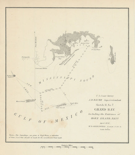
Grand Bay Including the Entrance of Horn Island Pass: Bache 1851
![Old map of the Mississippi Sound]()
- Regular price
- $55.00
- Sale price
- $55.00
- Regular price
-
- Unit price
- per
Sold -
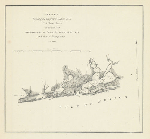
Reconnoissance of Pensacola and Perdido Bays: Bache 1849
![Old map of Pensacola Bay, Florida]()
- Regular price
- $55.00
- Sale price
- $55.00
- Regular price
-
- Unit price
- per
Sold -
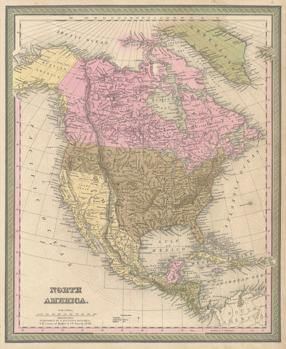
North America: Mitchell 1848
![Old map of North America]()
- Regular price
- $195.00
- Sale price
- $195.00
- Regular price
-
- Unit price
- per
Sold -
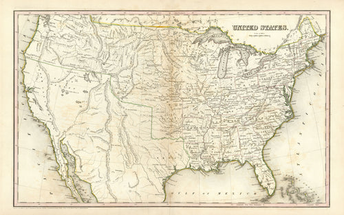
United States: Bradford 1838
![Old map of the United States with the Republic of Texas]()
- Regular price
- $950.00
- Sale price
- $950.00
- Regular price
-
- Unit price
- per
Sold -
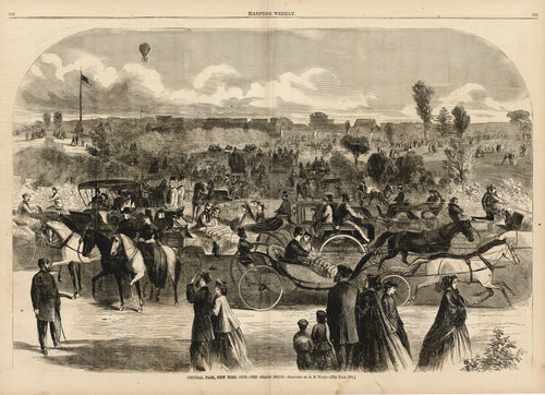
Central Park, New York City - The Grand Drive: Harper's Weekly 1865
![View of Central Park in New York City]()
- Regular price
- $55.00
- Sale price
- $55.00
- Regular price
-
- Unit price
- per
Sold -
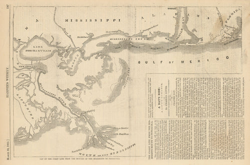
Map of the Coast Line from the Mouths of the Mississippi to Pensacola: Harper's Weekly 1861
![Old map of the mouth of the Mississippi]()
- Regular price
- $145.00
- Sale price
- $145.00
- Regular price
-
- Unit price
- per
Sold


- Previous page
- Page 6 of 17
- Next page