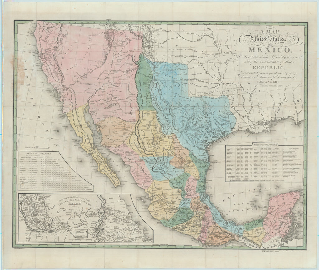
- Title: A Map of the United States of Mexico
- Author: Henry S. Tanner
- Date: 1846
- Condition: See bottom of description
- Inches: 28 7/8 x 22 1/2 [Image]
- Centimeters: 73.34 x 57.15 [Image]
- Product ID: 308123
Scarce Large-Scale Map of Mexico and the Southwest at the Outbreak of War
Third edition, 1846. Engraved folding pocket map with bright hand-coloring detailing the southwestern portion of North America, including all of Mexico. According to Rumsey, an earlier edition of this map is believed to have been the basis for the White, Gallaher & White Mapa de los Estados Unidos de Mejico that was copied by Disturnell and used in negotiations for the Treaty of Guadalupe Hidalgo in 1847. Of the five recorded editions, this one is considered to be the most significant as it was published on the eve of the Mexican-American War when curiosity and interest in Mexico were at their zenith. It features two table insets providing a Statistical Table and a Table of Distances, and a map inset titled Map of the Roads &c. From Vera Cruz & Alvarado to Mexico, which illustrates the route that General Winfield Scott would take the following year when he led the American forces from Vera Cruz to Mexico City.
Although this maps’ popularity resulted in Five editions with ten issues being published, this edition must have had exceptional demand, having been published shortly after war with Mexico erupted. The citizens, both north and south of the border would have been very keen to have a large-scale reference such as this map handy. Despite its clear popularity and many issues, few have survived to this day.
Reference
Ristow-Martin, "John Disturnell's Map of the United Mexican States," A la Carte, pages 207-208; Streeter 3824. Wheat, Trans Mississippi West, 364 (1825 issue).
Condition
Map neatly detached from boards. Evidence of professional restoration, including to a few pinholes of paper loss at intersections and usual separation at folds. Light scattered soiling and foxing. Colors remain bright and clear.


