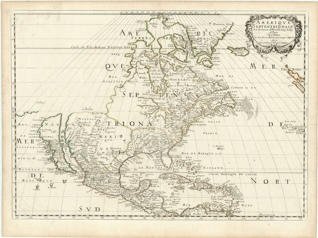
- Title: Amerique Septentrionale
- Author: Nicolas Sanson
- Date: 1650 [1659]
- Medium: Hand-colored copperplate engraving
- Condition: Very Good Plus - lovely example, original outline color, mild marginal age toning, more noticeable on verso. A few very minimal chips in margins, a few with expert repair, none into image. Expertly repaired separations at folds, not approaching image. An excellent example.
- Inches: 15 5/8 x 21 5/8 [Image]
- Centimeters: 39.69 x 54.93 [Image]
- Product ID: 315103
The most important French map of North America of its generation produced by France's most esteemed family of cartographers. Nicolas Sanson (1600-1667) played a seminal role in advancing French cartography during the reign of Louis XIV. Sanson was a student of history, and turned to cartography as a means of understanding and recording global events. Appointed as a tutor to Louis XIV, he became Géographe Oridinaire du Roi in 1630. His success was due in large part to his partnership with Pierre Mariette, who had purchased the stock of Melchoir Tavernier and provided financial support to Sanson. In 1657, Pierre Mariette died. His son, also named Pierre, co-published the following year. By 1665, Sanson’s sons, Adrien (d. 1708) and Guillaume (d. 1703), were active in the business, and ultimately succeeded him as geographers to the King. In 1692, Hubert Jaillot compiled Sanson's maps in an Atlas Nouveau.
Seventeenth-century French dominance of the North American interior resulted in a corresponding supremacy within the field of cartography. This highly influential map achieved many firsts: it properly showed the Great Lakes in recognizable form, named Lakes Superior and Ontario, located Santa Fe and Taos, and identified the domains of the Apache and Navajo. Additionally, the map hints at a Northwest Passage near the western extent of both Hudson and Baffin’s bays, with a magnificent baroque title cartouche, featuring swags and ribbons.
Drawn in the sinusoidal projection (sometimes called Sanson-Flamsteed) with the utmost care and scientific circumspection, the map's precision is due in large part to the manifold first-hand source accounts and documents available to Sanson. Much of this came from the Jesuit Relations, the extensively detailed reports of their missionary work in New France. Sanson relied heavily upon the 1647-1648 report, issued in Paris in 1649. The Relation relayed the first account of Niagara Falls, and described Lake Superior and Lake Michigan in great detail. The accuracy of Sanson's depiction of New France would remain unchallenged until the great 1688 Coronelli map.


