
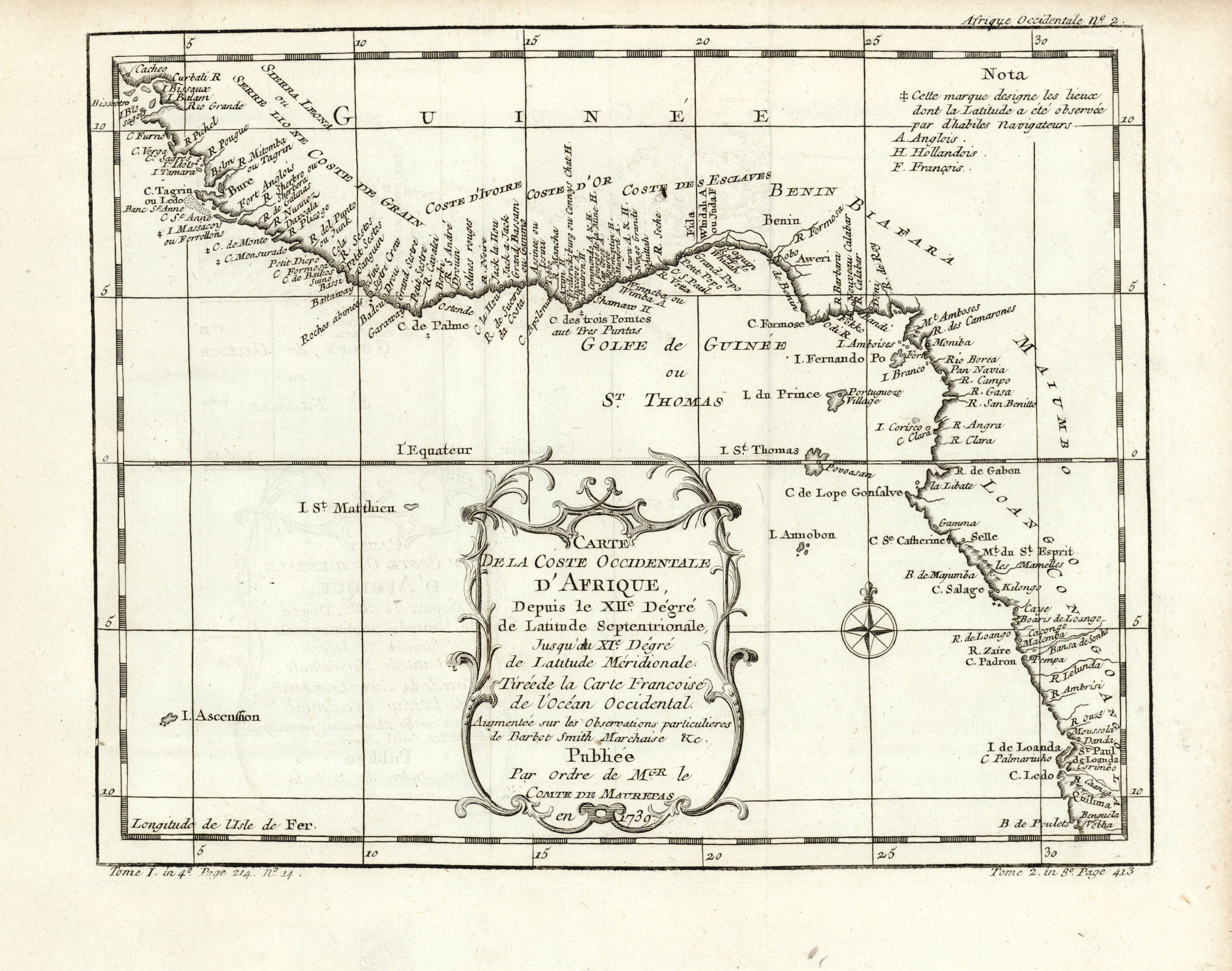
- Title: Carte de la Coste Occidentale d'Afrique
- Author: Jacques-Nicolas Bellin
- Date: 1739
- Medium: Copperplate engraving
- Condition: Very Good Plus - light age toning
- Inches: 13 x 9 3/4 [Paper]
- Centimeters: 33.02 x 24.77 [Paper]
- Product ID: 102164
Carte de la Coste Occidentale d'Afrique, Depuis le XIIe. Dégré de Latitude Septentrionale, Jusqu'au XIe. Dégré de Latitude Méridionale. Tirée de la Carte Francoise de l'Océan Occidental. Augmentée sur les Observations particulieres de Barbot Smith Marchaise &c. Publiée Par Ordre de Mgr. le Comte de Maurepas en 1739.
"Map of the West Coast of Africa, from the 12th Degree of Northern Latitude, Until the 11th Degree of Southern Latitude. Taken from the French Map of the Western Ocean. Augmented on the Particular Observations of Barbot, Smith, Marchaise & c. Published By Order of the Count of Maurepas in 1739."
Map of the west coast of Africa by French hydrographer and geographer Jacques-Nicolas Bellin (1703-1772), who produced a prodigious body of work over a nearly fifty-year career. Longitude from the Ferro Meridian.
Appointed hydrographer of the French Navy at the age of eighteen, Bellin eventually became Hydrographer to the King in 1741. He published numerous sea atlases and charts which would be reprinted into the nineteenth century, as well as many maps depicting French colonial territories in the New World. His craftsmanship and commitment to accuracy earned him a distinguished reputation as one of the world's leading cartographers, and many other European mapmakers turned to him for source material.