
- Title: Carte Particuliere de l'Isle de Juan Fernandés
- Author: Jacques-Nicolas Bellin
- Date: c. 1760
- Medium: Copperplate engraving
- Condition: Very Good Plus - age toning, light foxing
- Inches: 14 3/4 x 10 [Paper]
- Centimeters: 37.47 x 25.4 [Paper]
- Product ID: 102152
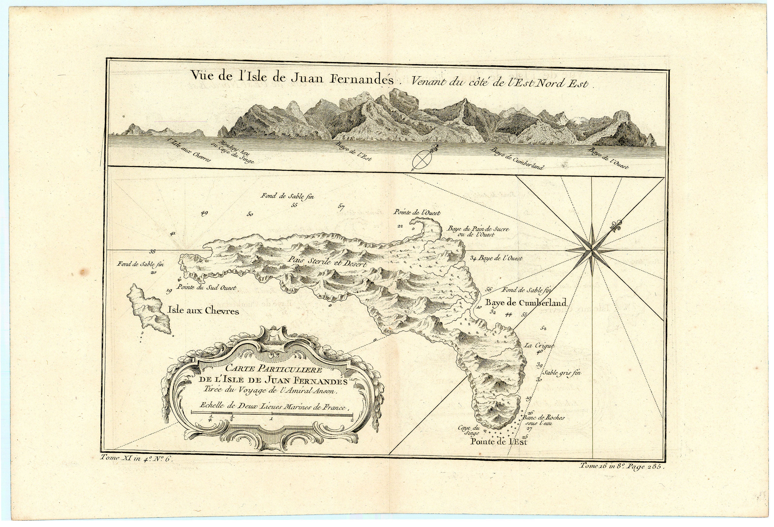
Carte Particuliere de l'Isle de Juan Fernandés Tirée du Voyage de l'Amiral Anson. Echelle de Deux Lieues Marines de France.
Vüe de l'Isle de Juan Fernandés. Venant du côté de l'Est Nord Est.
"Particular Map of the Island of Juan Fernandés From the Voyage of Admiral Anson. Scale of Two French Marine Leagues.
View of the Isle of Juan Fernandés. Coming from the East North East side."
Map of the Juan Fernández Islands, an archipelago off the coast of Chile. The islands were first recorded in 1574 by Spanish sailor Juan Fernández, who named the islands Más Afuera, Más a Tierra, and Santa Clara. Famously, Scottish sailor Alexander Selkirk became marooned on the island for five years between 1704 and 1709, inspiring British author Daniel Defoe to write his novel Robinson Crusoe, published in 1719. Today, the islands Más Afuera and Más a Tierra have been renamed Alejandro Selkirk Island and Robinson Crusoe Island, respectively. In the 1740s, British Commodore George Anson would arrive at the islands with what remained of his fleet during his ill-fated voyage around the world.