
- Title: Chili
- Author: Willem Janszoon Blaeu
- Date: 1630
- Medium: Hand-colored copperplate engraving
- Condition: Very Good - age toning, foxing, issued center fold
- Inches: 16 1/4 x 14 1/2 [Image]
- Centimeters: 41.3 x 36.8 [Image]
- Product ID: 233065
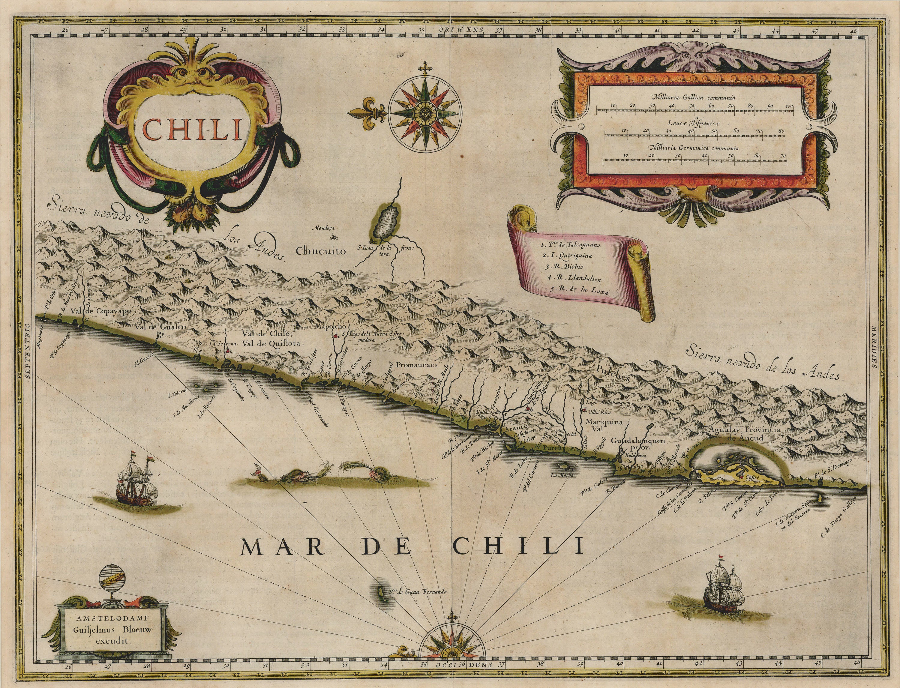
This exquisite first-state map with original color dates to 1630 and was created by famous Dutch cartographer, atlas maker, and publisher Willem Blaeu. It shows the coast of Chile as it appeared during the period of Spanish colonial occupation, detailing topographic features such as the Andes Mountains. Orientation is such that North corresponds to the map's left-hand margin, and a cartouche with a numbered legend indicated various cities and sites of import.
Dutch cartographer Willem Blaeu (1571-1638), and later his heirs, dominated the world cartographic landscape for much of the seventeenth century. Blaeu studied under Danish astronomer Tycho Brahe, one of the major figures in the history of modern astronomy. After returning to the Low Countries from Denmark in the late 1590s, Blaeu set up shop as a cartographer and globe maker. He produced numerous atlases, and in 1633 became the official mapmaker of the Dutch East India Company, the megacorporation which, thanks to Dutch naval prowess, controlled the seventeenth-century global economy. Numerous depictions of Blaeu maps appear in the work of Johannes Vermeer (1632-1675), one of the greatest painters of the Dutch Golden Age. Blaeu's sons, cartographers Cornelis and Joan (or Johannes) Blaeu, took over the family business after their father's death.