
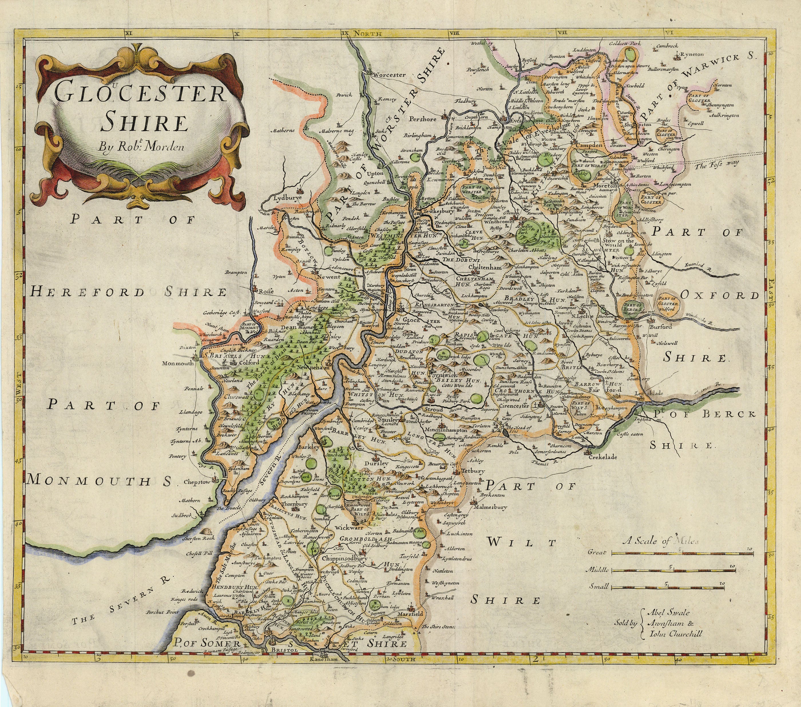
- Title: Gloucestershire
- Author: Robert Morden
- Date: 1695
- Medium: Hand-colored copperplate engraving
- Condition: Fair - age toning, light foxing, surface dirt, issued center fold, light creasing throughout
- Inches: 16 1/2 x 13 3/4 [Image]
- Centimeters: 41.91 x 34.93 [Image]
- Product ID: 101097
Map of the county of Gloucestershire along the banks of the Severn River at the border between England and Wales. Depicts parts of Herefordshire, Monmouthshire, Wiltshire, Warwickshire, Oxfordshire, Berkshire, Somersetshire, and Worcestershire. Also features the cities of Bristol, Gloucester, and Cheltenham, as well as the Forest of Dean and part of the River Thames.
Background on Creator
Robert Morden (c. 1650–1703) was a prominent English bookseller, publisher, mapmaker, globe maker, and engraver, recognized as one of the first successful commercial mapmakers of his era. Operating from premises in Cornhill and New Cheapside, London, "under the sign of the Atlas," Morden produced a large and varied body of cartographic work between about 1675 and his death in 1703. He is best known for his detailed maps of South Wales, North Wales, and the English counties, which were first published in the 1695 edition of William Camden’s Britannia and subsequently reissued throughout the 18th century. These maps were notable for their decorative cartouches and the inclusion of numerous place names, often based on updated information provided by local gentlemen from each county.