
- Title: Plan of Mier the Texian Camp
- Author: William Kemble
- Date: 1844
- Medium: Steel engraving
- Condition: Very Good Plus
- Inches: 10.5 x 6 [Image]
- Centimeters: 26.6 x 15.2 [Image]
- Product ID: 233159
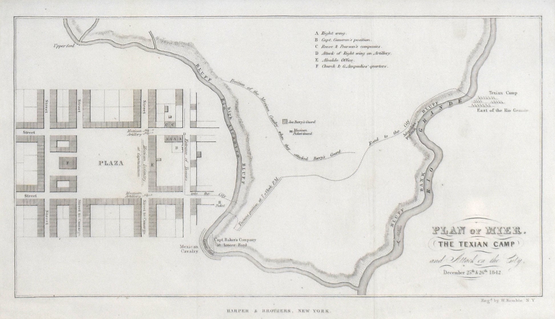
Full Title: "Plan of Mier. The Texian Camp and Attack on the City, December 25 &26 1842."
During the late 1830's and early 1840's, the Republic of Texas sent several raiding expeditions into disputed territory between the Nueces River and the Rio Grande. The most disastrous of these operations was the Mier Expedition. This map, produced by William Kemble in 1844, depicts a town plan of Mier, a plan of the Texian expedition's camp and the Rio Grande River.
Background on Creator
William Kemble (1813-c.1870) was an American engraver active in the early 20th century, best known for his finely detailed work on financial documents such as stock certificates and bonds. His name appears in the imprints of numerous decorative securities, often alongside ornate borders and allegorical vignettes that exemplify the golden age of American steel‑plate engraving. Collectors today value certificates bearing his imprint both for their aesthetic quality and as examples of specialist security engraving of the period.