
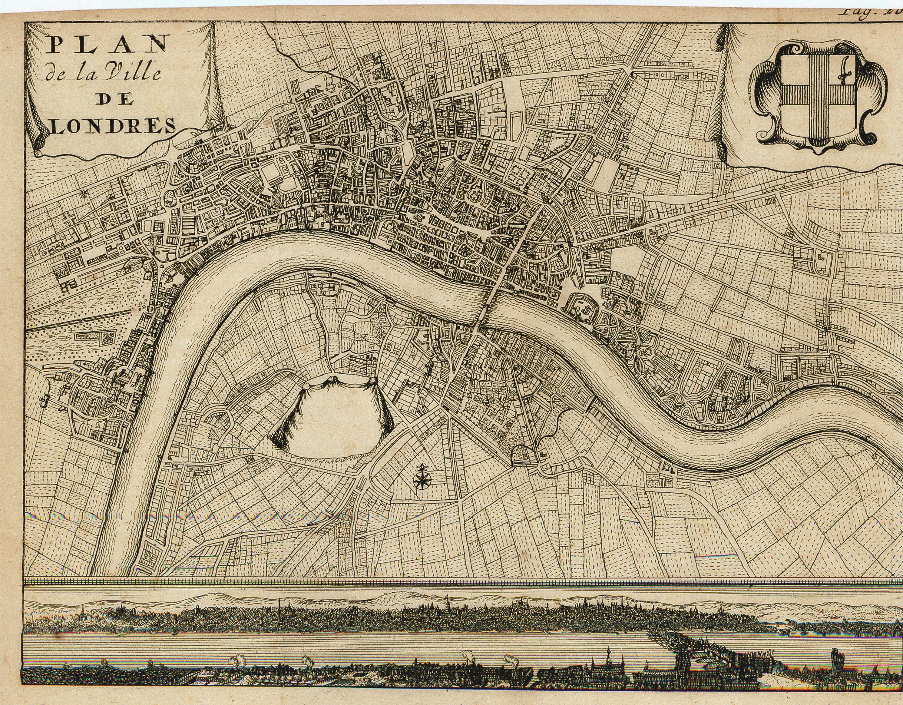
- Title: Plan de la Ville de Londres
- Author: Henry van Bulderen
- Date: 1698
- Medium: Copperplate engraving
- Condition: Very Good - trimmed margins, age toning, vertical fold lines
- Inches: 7 3/8 x 6 [Paper]
- Centimeters: 18.73 x 15.24 [Paper]
- Product ID: 318038
Small French map of the city of London, England published by Henry van Bulderen in 1698 and based on a 1690 map by Joannes de Ram. To the upper right, van Bulderen includes the city of London's coat of arms. Below the map, he also features an image of the River Thames inspired by Matthäus Merian's view of London.