
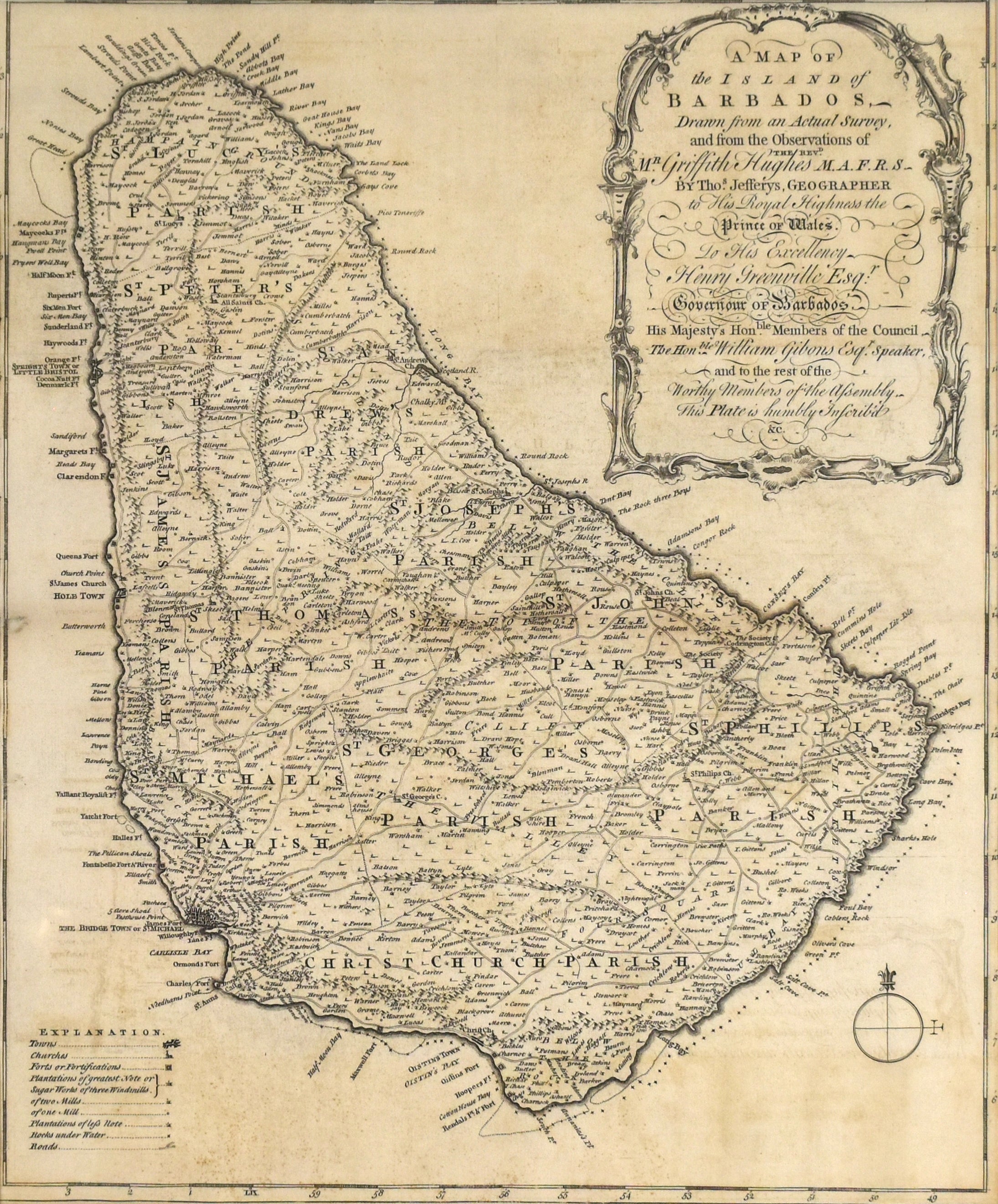
- Title: The Island of Barbados
- Author: Thomas Jefferys
- Date: 1750
- Medium: Copperplate engraving
- Condition: Very Good +
- Inches: 13 5/8 x 16 1/2 [Image]
- Centimeters: 37.15 x 41.91 [Image]
- Product ID: 233062
A Map of the Island of Barbados Drawn from an Actual Survey and from the Observations of the Rev. Mr. Griffith Hughes M.A.F.R.S. by Thos. Jefferys, Geographer to His Royal Highness the Prince of Wales. To His Excellency Henry Greenville Esqr. Governour of Barbados, His Majesty's Honble. Members of the Council, The Honble. William Gibons Esqr. Speaker, and the the rest of the Worthy Members of the Assembly, This Plate is humbly Inscrib'd &c.
By the end of the eighteenth century, Britain had established itself as the world’s leading naval superpower, a development which went hand-in-hand with cartographic advancement. One of the cartographers who contributed to this phenomenon was Thomas Jefferys (c. 1719-1771), Royal Geographer to King George III. We know little of his background, save that he married in 1750 and seemed to identify primarily as an engraver, rather than as a geographer. In 1766 he went bankrupt, which gave publisher Robert Sayer the opportunity to purchase a large portion of Jefferys’ materials and plates. Following this setback, Jefferys did continue to publish maps in partnership with the younger William Faden.