
Collection: Europe
A collection of antique maps dating from the fifteenth through the nineteenth centuries depicting Europe and its comprising nations. Includes Ireland, the United Kingdom, France, Germany, Italy, Norway, Sweden, Switzerland, the Netherlands, Poland, Belgium, Greece, Austria, Denmark, Croatia, Ukraine, Iceland, and others.
-
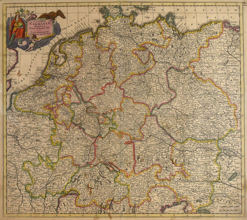
Accuratissima Germaniæ Tabula: Danckerts 1690
![Old map of Germany]()
- Regular price
- $595.00
- Sale price
- $595.00
- Regular price
-
- Unit price
- per
Sold -
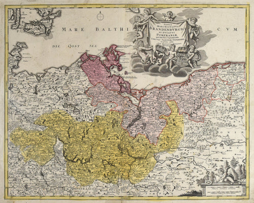
Tabula Marchionatus Brandenburgici et Ducatus Pomeraniae: Homann c. 1720
![]()
- Regular price
- $695.00
- Sale price
- $695.00
- Regular price
-
- Unit price
- per
Sold -
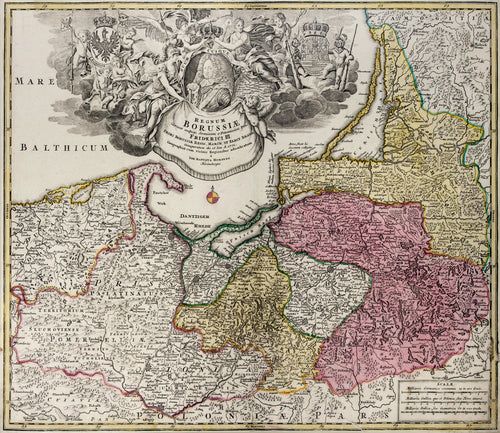
Regnum Borussiae: Homann c. 1715
![]()
- Regular price
- $475.00
- Sale price
- $475.00
- Regular price
-
- Unit price
- per
Sold -
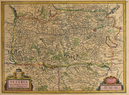
Avstria Archidvcatvs: Jansson 1642
![]()
- Regular price
- $675.00
- Sale price
- $675.00
- Regular price
-
- Unit price
- per
Sold -
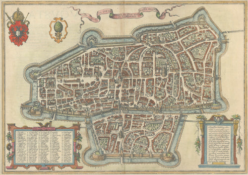
Augusta Iuxta Figuram Quam Hisce Temporibus Habet Delineata: Braun & Hogenberg 1572
![Old map of Augsburg, Germany]()
- Regular price
- $495.00
- Sale price
- $495.00
- Regular price
-
- Unit price
- per
Sold -
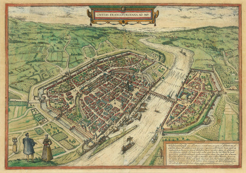
Civitas Francofordiana ad Moe: Braun & Hogenberg 1572, Fine Renaissance View of Frankfort
![Old map of Frankfurt, Germany]()
- Regular price
- $850.00
- Sale price
- $850.00
- Regular price
-
- Unit price
- per
Sold -
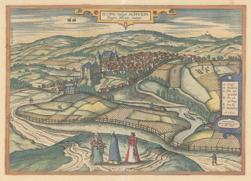
Scopa Vulgo Schuepa Elegans Misniae Civitas: Braun & Hogenberg 1617
![Old map of Zschopau, Germany]()
- Regular price
- $995.00
- Sale price
- $995.00
- Regular price
-
- Unit price
- per
Sold


- Previous page
- Page 2 of 2