Collection: British Isles
Original antique maps depicting the British Isles and the United Kingdom. Includes Ireland, Wales, Scotland, England, Northern Ireland, the Isle of Wight, and the Isle of Mann.
-
Guide for Excursions on the River Thames, From Eton to the Nore: Illustrated London News, 1849
![]()

- Regular price
- $495.00
- Sale price
- $495.00
- Regular price
-
- Unit price
- per
Sold -
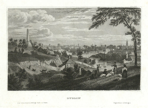
Dublin: Bibliographisches Institut c. 1840
![Old view of Dublin, Ireland]()
- Regular price
- $75.00
- Sale price
- $75.00
- Regular price
-
- Unit price
- per
Sold -
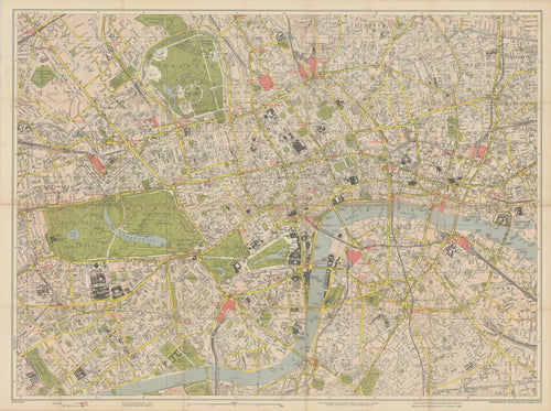
Vest Pocket Street Plan of Central London: Geographia Ltd. c. 1955
![Old map of London, England]()
- Regular price
- $195.00
- Sale price
- $195.00
- Regular price
-
- Unit price
- per
Sold -
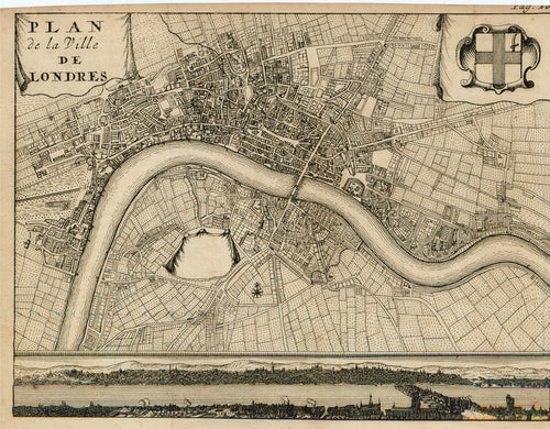
Plan de la Ville de Londres: Van Bulderen 1698
![Old map of the city of London, England]()
- Regular price
- $150.00
- Sale price
- $150.00
- Regular price
-
- Unit price
- per
Sold -
An Entire New Plan of the Cities of London & Westminster...: Darton, 1817
![]()
- Regular price
- $2,495.00
- Sale price
- $2,495.00
- Regular price
-
- Unit price
- per
Sold -
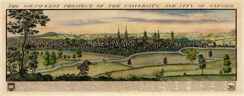
The Southwest Prospect of the University, and City of Oxford: Buck 1731
![Old map of Oxford University]()
- Regular price
- $1,600.00
- Sale price
- $1,600.00
- Regular price
-
- Unit price
- per
Sold -
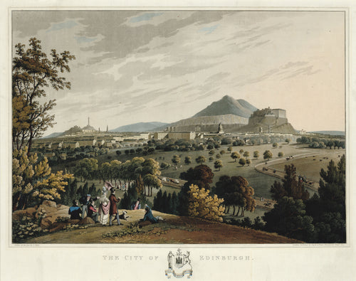
The City of Edinburgh: Clark 1824
![]()
- Regular price
- $1,900.00
- Sale price
- $1,900.00
- Regular price
-
- Unit price
- per
Sold -
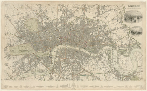
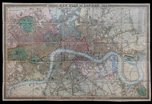
Cross's New Plan of London, 1836
![]()
- Regular price
- $2,500.00
- Sale price
- $2,500.00
- Regular price
-
- Unit price
- per
Sold -
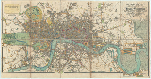
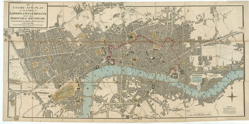
An Entire New Plan of the Cities of London & Westminster; With the Borough of Southwark: Mogg 1804
![Old map of the city of London]()
- Regular price
- $1,695.00
- Sale price
- $1,695.00
- Regular price
-
- Unit price
- per
Sold -
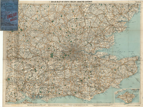
Road-Map of Fifty Miles Around London: G. W. Bacon & Co. c. 1900
![Old map of southeast England]()
- Regular price
- $295.00
- Sale price
- $295.00
- Regular price
-
- Unit price
- per
Sold