Collection: Europe
A collection of antique maps dating from the fifteenth through the nineteenth centuries depicting Europe and its comprising nations. Includes Ireland, the United Kingdom, France, Germany, Italy, Norway, Sweden, Switzerland, the Netherlands, Poland, Belgium, Greece, Austria, Denmark, Croatia, Ukraine, Iceland, and others.
-
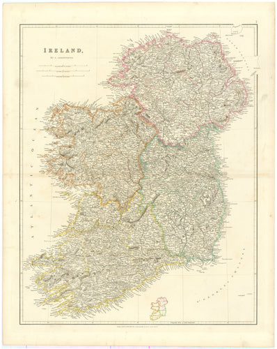
A New Map of Ireland: Moll, c.1725
![]()

- Regular price
- $2,195.00
- Sale price
- $2,195.00
- Regular price
-
- Unit price
- per
Sold -
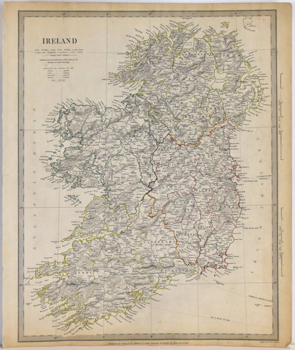
Ireland: Arrowsmith, 1832
![]()
- Regular price
- $1,495.00
- Sale price
- $1,495.00
- Regular price
-
- Unit price
- per
Sold -
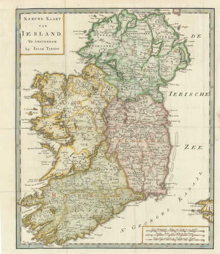
Nieuwe Kaart van Ierland: Tirion, 1754
![Antique map of Ireland]()
- Regular price
- $345.00
- Sale price
- $345.00
- Regular price
-
- Unit price
- per
Sold -
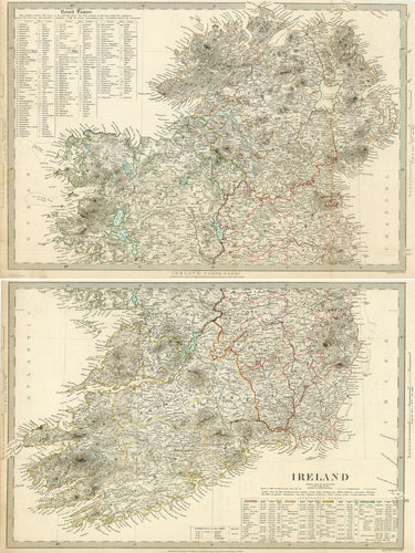
Ireland [Double Sheet]: SDUK 1838
![Old map of Ireland]()
- Regular price
- $245.00
- Sale price
- $245.00
- Regular price
-
- Unit price
- per
Sold -
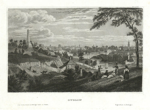
Dublin: Bibliographisches Institut c. 1840
![Old view of Dublin, Ireland]()
- Regular price
- $75.00
- Sale price
- $75.00
- Regular price
-
- Unit price
- per
Sold -
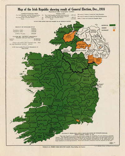
One Map, Two Irelands. Map of the Irish Republic Showing Result of General Election, Dec., 1918
![]()
- Regular price
- $795.00
- Sale price
- $795.00
- Regular price
-
- Unit price
- per
Sold -
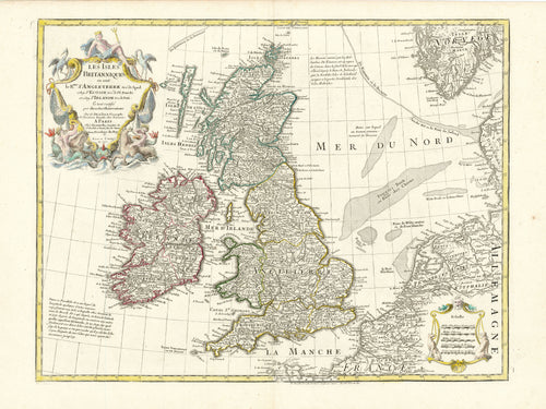
Les Isles Britanniques: Dezauche 1772
![Old map of the British Isles]()
- Regular price
- $500.00
- Sale price
- $500.00
- Regular price
-
- Unit price
- per
Sold -
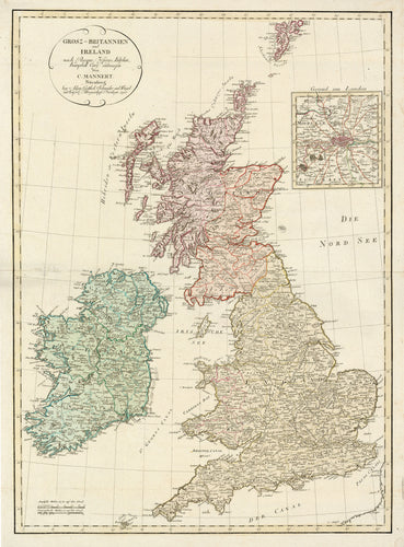
Grosz-Britannien und Ireland: Mannert 1795
![Old map of the British Isles]()
- Regular price
- $500.00
- Sale price
- $500.00
- Regular price
-
- Unit price
- per
Sold -
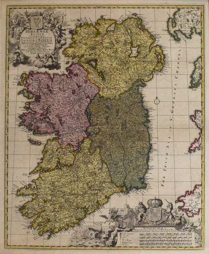
Ireland: N. Visscher c. 1680
![]()
- Regular price
- $950.00
- Sale price
- $950.00
- Regular price
-
- Unit price
- per
Sold -
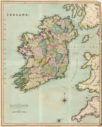
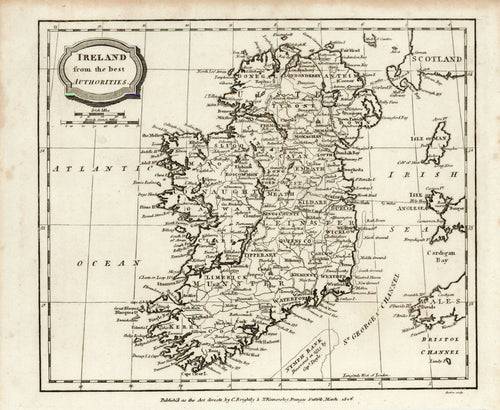
Ireland From the Best Authorities: Brightly & Kinnersley 1806
![Old map of Ireland]()
- Regular price
- $175.00
- Sale price
- $175.00
- Regular price
-
- Unit price
- per
Sold -
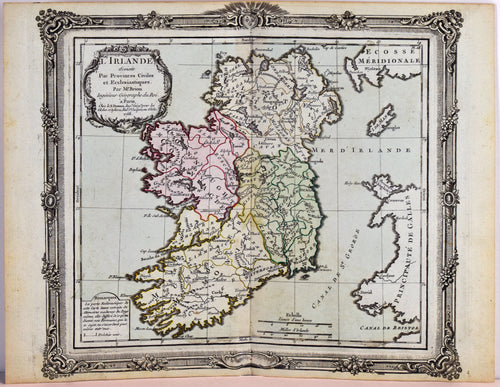
L' Irelande: Brion de la Tour c. 1770
![]()
- Regular price
- $195.00
- Sale price
- $195.00
- Regular price
-
- Unit price
- per
Sold